Area Overview for BN20 0HY
Photos of BN20 0HY
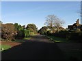
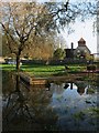
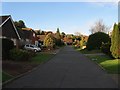
100 photos from this area
Area Information
Key information about the BN20 0HY including its size, population, and administrative classification.
- Area Type
- Postcode
- Area Size
- 2.5 hectares
- Population
- 2215
- Population Density
- 52 people/km²
House Prices in BN20 0HY
13
Properties
£512,167
Average Sold Price
£172,000
Lowest Price
£700,000
Highest Price
Showing 13 properties
| Address | Type | Beds | Baths | Last Sale Price | Last Sale Date | |
|---|---|---|---|---|---|---|
| 23 Deneside, East Dean, BN20 0HY | Detached | 3 | 2 | £700,000 | Apr 2025 | |
| 25 Deneside, East Dean, BN20 0HY | house | - | - | £550,000 | Oct 2021 | |
| 33 Deneside, East Dean, BN20 0HY | house | - | - | £650,000 | Jun 2021 | |
| 43 Deneside, East Dean, BN20 0HY | Detached | 4 | 4 | £590,000 | Feb 2020 | |
| 45 Deneside, East Dean, BN20 0HY | house | 3 | - | £567,500 | Dec 2018 | |
| 29 Deneside, East Dean, BN20 0HY | Bungalow | - | - | £460,000 | Sep 2018 | |
| 21 Deneside, East Dean, BN20 0HY | house | 3 | 2 | £425,000 | Aug 2011 | |
| 27 Deneside, East Dean, BN20 0HY | Bungalow | - | - | £495,000 | Mar 2010 | |
| 41 Deneside, East Dean, BN20 0HY | Detached | - | - | £172,000 | Nov 1998 | |
| 31 Deneside, East Dean, BN20 0HY | Detached | - | - | - | - |
Page 1 of 2
Energy Efficiency in BN20 0HY
Amenities
Schools
| Rank | School | Type | Entry gender | Ages |
|---|
Explore more schools in this area
Go to Schools tabDemographics
Household Size
Two person
most common
Accommodation Type
Houses
most common
Tenure
84
majority
Ethnic Group
White
most common
Religion
N/A
most common
Household Composition
N/A
most common
Age
47
median
Elderly (65+ years)
most common
Household Deprivation
N/A
with no deprivation
NS-SEC
50
in Lower managerial occupations
Explore more demographic insights in this area
Go to Demographics tabPlanning
Planning Constraints
- Flood RiskPremium
- Ramsar Wetland SitesPremium
- Area of Outstanding Natural BeautyPremium
- Protected Nature ReservePremium
- Protected WoodlandPremium