Area Overview for BN2 3HX
Photos of BN2 3HX
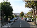
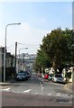
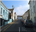
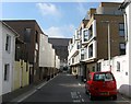

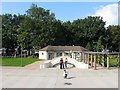

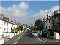
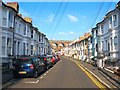
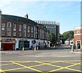
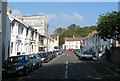
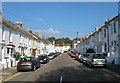
100 photos from this area
Area Information
Key information about the BN2 3HX including its size, population, and administrative classification.
- Area Type
- Postcode
- Area Size
- 6294 m²
- Population
- 1960
- Population Density
- 20103 people/km²
House Prices in BN2 3HX
60
Properties
£333,223
Average Sold Price
£69,000
Lowest Price
£615,000
Highest Price
Showing 60 properties
| Address | Type | Beds | Baths | Last Sale Price | Last Sale Date | |
|---|---|---|---|---|---|---|
| 26 Caledonian Road, Brighton, BN2 3HX | Terraced | 3 | 1 | £450,000 | Jul 2025 | |
| 27 Caledonian Road, Brighton, BN2 3HX | Terraced | 6 | 2 | £497,500 | Jun 2024 | |
| 31 Caledonian Road, Brighton, BN2 3HX | Terraced | 4 | 2 | £615,000 | Jun 2023 | |
| 17 Caledonian Road, Brighton, BN2 3HX | Maisonette | 3 | 1 | £290,000 | Jun 2023 | |
| 32 Caledonian Road, Brighton, BN2 3HX | house | 2 | - | £430,000 | Feb 2022 | |
| 25 Caledonian Road, Brighton, BN2 3HX | Detached | 6 | 2 | £422,500 | Oct 2020 | |
| 35 Caledonian Road, Brighton, BN2 3HX | Terraced | 6 | 6 | £595,000 | Oct 2020 | |
| 28 Caledonian Road, Brighton, BN2 3HX | Terraced | 6 | 3 | £430,000 | Jun 2019 | |
| 6 Caledonian Road, Brighton, BN2 3HX | house | - | - | £500,000 | Apr 2019 | |
| 15 Caledonian Road, Brighton, BN2 3HX | house | - | - | £570,000 | Apr 2019 |
Page 1 of 6
Energy Efficiency in BN2 3HX
Amenities
Schools
| Rank | School | Type | Entry gender | Ages |
|---|
Explore more schools in this area
Go to Schools tabDemographics
Household Size
Family (3-5 people)
most common
Accommodation Type
Flats
most common
Tenure
34
majority
Ethnic Group
White
most common
Religion
N/A
most common
Household Composition
N/A
most common
Age
22
median
Young Adults (15-29 years)
most common
Household Deprivation
N/A
with no deprivation
NS-SEC
23
in Lower managerial occupations
Explore more demographic insights in this area
Go to Demographics tabPlanning
Planning Constraints
- Flood RiskPremium
- Ramsar Wetland SitesPremium
- Area of Outstanding Natural BeautyPremium
- Protected Nature ReservePremium
- Protected WoodlandPremium