Area Overview for BN2 3JG
Photos of BN2 3JG
Area Information
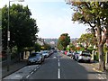
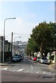
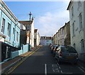
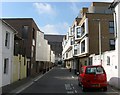
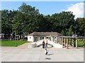
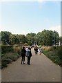
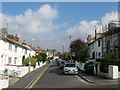
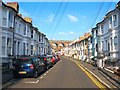
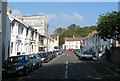
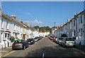
BN2 3JG lies within the Round Hill area of Brighton and Hove, a historic suburban district shaped by Victorian and Edwardian development. With a population of 1,960, this small postcode cluster reflects Brighton’s northward expansion from its original town centre. The area is defined by its conservation status, preserving 19th-century terraced and semi-detached housing, including notable features like Round Hill Crescent’s stuccoed three-storey homes. Situated on the northern slopes of the South Downs, it blends suburban tranquillity with proximity to the city’s amenities. Daily life here is characterised by a young demographic, with most residents aged 15–29, reflecting a dynamic, student- and young professional-oriented community. The area’s rail links to London Road and Moulsecoomb stations provide swift access to Brighton’s cultural hubs, while nearby shops and services cater to local needs. Its compact size and historic charm make it a distinct choice for those seeking a balance between heritage and modern convenience.
- Area Type
- Postcode
- Area Size
- Not available
- Population
- 1960
- Population Density
- 20103 people/km²
The property market in BN2 3JG is characterised by a low home ownership rate (34%) and a predominance of flats, reflecting its origins as a 19th-century suburban development. This suggests the area functions more as a rental market than an owner-occupied one, with limited availability of larger homes. The conservation area designation adds complexity, as it restricts alterations to historic properties, potentially limiting renovation opportunities. For buyers, this small postcode cluster may offer limited scope for property acquisition, with competition likely among those seeking affordable housing near Brighton’s amenities. The flat stock caters to students and young professionals, but buyers should consider the area’s compact size and the challenges of securing a long-term hold in a market skewed toward renters.
House Prices in BN2 3JG
No properties found in this postcode.
Energy Efficiency in BN2 3JG
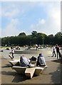
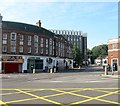
Living in BN2 3JG grants access to a range of practical amenities within walking or short driving distance. Retail options include Co-op Lewes, Sainsburys Lewes, and M&S University Brighton BP, catering to daily shopping needs. The nearby railway stations—London Road, Moulsecoomb, and Preston Park—offer swift connections to Brighton’s cultural and commercial centres, as well as onward travel to London and the South Coast. While the area’s historic character limits large-scale leisure facilities, its proximity to the South Downs provides opportunities for outdoor activities. The mix of retail, transport, and historic surroundings creates a convenient, compact lifestyle suited to those valuing accessibility over sprawling suburban sprawl.
Amenities
Schools
| Rank | School | Type | Entry gender | Ages |
|---|
Explore more schools in this area
Go to Schools tabDemographics
BN2 3JG has a median age of 22, with the majority of residents aged 15–29, indicating a youthful, transient community. Home ownership here is relatively low at 34%, suggesting a higher proportion of renters, likely including students and young professionals. The accommodation type is predominantly flats, reflecting the area’s historic development as a suburban residential cluster. The predominant ethnic group is White, though no specific diversity statistics are provided. This age profile implies a focus on affordability and proximity to education, with the area’s proximity to the University of Brighton likely influencing its demographic makeup. The low home ownership rate may impact long-term investment potential, while the flat-dominated stock suits those prioritising convenience over larger properties.
Household Size
Accommodation Type
Tenure
Ethnic Group
Religion
Household Composition
Age
Household Deprivation
NS-SEC
Explore more demographic insights in this area
Go to Demographics tabPlanning
Planning Constraints
- Flood RiskPremium
- Ramsar Wetland SitesPremium
- Area of Outstanding Natural BeautyPremium
- Protected Nature ReservePremium
- Protected WoodlandPremium