Area Overview for BN2 3HD
Photos of BN2 3HD
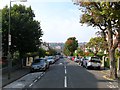
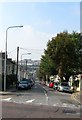
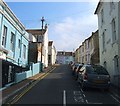
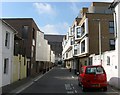
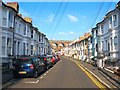
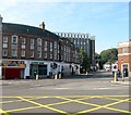
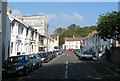
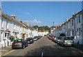
100 photos from this area
Area Information
Key information about the BN2 3HD including its size, population, and administrative classification.
- Area Type
- Postcode
- Area Size
- 5171 m²
- Population
- 1730
- Population Density
- 13442 people/km²
House Prices in BN2 3HD
31
Properties
£384,060
Average Sold Price
£80,000
Lowest Price
£702,000
Highest Price
Showing 31 properties
| Address | Type | Beds | Baths | Last Sale Price | Last Sale Date | |
|---|---|---|---|---|---|---|
| 26A Park Crescent Terrace, Brighton, BN2 3HD | Flat | - | - | £417,000 | Jul 2025 | |
| 32 Park Crescent Terrace, Brighton, BN2 3HD | Terraced | 3 | 2 | £645,000 | Apr 2024 | |
| 37 Park Crescent Terrace, Brighton, BN2 3HD | house | 3 | 2 | £702,000 | Jun 2022 | |
| 36 Park Crescent Terrace, Brighton, BN2 3HD | Terraced | 3 | 1 | £530,000 | Feb 2021 | |
| 7 Park Crescent Terrace, Brighton, BN2 3HD | house | 4 | 1 | £600,000 | Aug 2019 | |
| 38 Park Crescent Terrace, Brighton, BN2 3HD | Terraced | 6 | 3 | £600,000 | Mar 2019 | |
| 8 Park Crescent Terrace, Brighton, BN2 3HD | house | - | - | £451,000 | May 2014 | |
| Gordon House, 9 Park Crescent Terrace, Brighton, BN2 3HD | Terraced | 4 | 1 | £340,000 | Mar 2012 | |
| 14 Park Crescent Terrace, Brighton, BN2 3HD | Terraced | 3 | 2 | £380,000 | Feb 2008 | |
| 31 Park Crescent Terrace, Brighton, BN2 3HD | Detached | - | - | £235,000 | Mar 2004 |
Page 1 of 4
Energy Efficiency in BN2 3HD
Amenities
Schools
| Rank | School | Type | Entry gender | Ages |
|---|
Explore more schools in this area
Go to Schools tabDemographics
Household Size
One person
most common
Accommodation Type
Flats
most common
Tenure
35
majority
Ethnic Group
White
most common
Religion
N/A
most common
Household Composition
N/A
most common
Age
22
median
Young Adults (15-29 years)
most common
Household Deprivation
N/A
with no deprivation
NS-SEC
29
in Lower managerial occupations
Explore more demographic insights in this area
Go to Demographics tabPlanning
Planning Constraints
- Flood RiskPremium
- Ramsar Wetland SitesPremium
- Area of Outstanding Natural BeautyPremium
- Protected Nature ReservePremium
- Protected WoodlandPremium