Area Overview for BN18 0LS
Photos of BN18 0LS


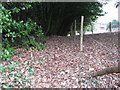

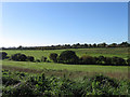
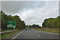
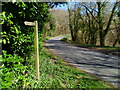
30 photos from this area
Area Information
Key information about the BN18 0LS including its size, population, and administrative classification.
- Area Type
- Postcode
- Area Size
- 29.7 hectares
- Population
- 1362
- Population Density
- 52 people/km²
House Prices in BN18 0LS
12
Properties
£641,667
Average Sold Price
£225,000
Lowest Price
£850,000
Highest Price
Showing 12 properties
| Address | Type | Beds | Baths | Last Sale Price | Last Sale Date | |
|---|---|---|---|---|---|---|
| Old School Laundry House, Yapton Lane, Walberton, BN18 0LS | Detached | 4 | 2 | £850,000 | Jul 2020 | |
| Little Danes, Yapton Lane, Walberton, BN18 0LS | house | - | - | £850,000 | Nov 2019 | |
| 3, Swiss Cottages, Yapton Lane, Walberton, BN18 0LS | house | - | - | £225,000 | Jul 2005 | |
| Oaks Cottage, Yapton Lane, Walberton, BN18 0LS | Semi-detached | 2 | - | - | - | |
| Oaks House, Yapton Lane, Walberton, BN18 0LS | Detached | 4 | 2 | - | - | |
| 1-2, Swiss Cottages, Yapton Lane, Walberton, BN18 0LS | Semi-detached | 2 | - | - | - | |
| Tennis 129M From Avisford Park Hotel, Yapton Lane 111M From Unnamed Road, Fairway Close, Walberton, BN18 0LS | Leisure | - | - | - | - | |
| Staff Quarters, Avisford Park Hotel, Yapton Lane, Walberton, BN18 0LS | Unknown | - | - | - | - | |
| The Caravan, Littlewoods Nursery, Yapton Lane, Walberton, BN18 0LS | Mobile Home | - | - | - | - | |
| Lowman Hotel (arundel) Ltd, Avisford Park Hotel, Yapton Lane, Walberton, BN18 0LS | hotel | - | - | - | - |
Page 1 of 2
Energy Efficiency in BN18 0LS
Amenities
Schools
| Rank | School | Type | Entry gender | Ages |
|---|
Explore more schools in this area
Go to Schools tabDemographics
Household Size
Two person
most common
Accommodation Type
Houses
most common
Tenure
77
majority
Ethnic Group
White
most common
Religion
N/A
most common
Household Composition
N/A
most common
Age
47
median
Adults (30-64 years)
most common
Household Deprivation
N/A
with no deprivation
NS-SEC
40
in Lower managerial occupations
Explore more demographic insights in this area
Go to Demographics tabPlanning
Planning Constraints
- Flood RiskPremium
- Ramsar Wetland SitesPremium
- Area of Outstanding Natural BeautyPremium
- Protected Nature ReservePremium
- Protected WoodlandPremium