Area Overview for BN12 4PY
Photos of BN12 4PY
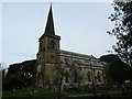
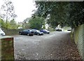
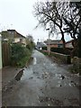
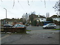
100 photos from this area
Area Information
Key information about the BN12 4PY including its size, population, and administrative classification.
- Area Type
- Postcode
- Area Size
- 1.9 hectares
- Population
- 1648
- Population Density
- 2891 people/km²
House Prices in BN12 4PY
24
Properties
£493,739
Average Sold Price
£160,000
Lowest Price
£915,000
Highest Price
Showing 24 properties
| Address | Type | Beds | Baths | Last Sale Price | Last Sale Date | |
|---|---|---|---|---|---|---|
| 10 Sea Lane, Goring, Worthing, BN12 4PY | Flat | 3 | 2 | £415,000 | Aug 2025 | |
| 14 Sea Lane, Goring, Worthing, BN12 4PY | Detached | 3 | 2 | £845,000 | Apr 2025 | |
| 52 Sea Lane, Goring, Worthing, BN12 4PY | house | 3 | 1 | £830,000 | Sep 2023 | |
| 4 Sea Lane, Goring, Worthing, BN12 4PY | Flat | 3 | 1 | £450,000 | Oct 2022 | |
| 50 Sea Lane, Goring, Worthing, BN12 4PY | house | 3 | 1 | £643,000 | Jun 2022 | |
| 66 Sea Lane, Goring, Worthing, BN12 4PY | Detached | 4 | 2 | £820,000 | Sep 2021 | |
| 2 Sea Lane, Goring, Worthing, BN12 4PY | Detached | 4 | 2 | £915,000 | Aug 2021 | |
| 68 Sea Lane, Goring, Worthing, BN12 4PY | Detached | 4 | 2 | £655,000 | Feb 2021 | |
| 16 Sea Lane, Goring, Worthing, BN12 4PY | house | - | - | £637,000 | Dec 2020 | |
| 62 Sea Lane, Goring, Worthing, BN12 4PY | Detached | 4 | - | £630,000 | Feb 2018 |
Page 1 of 3
Energy Efficiency in BN12 4PY
Amenities
Schools
| Rank | School | Type | Entry gender | Ages |
|---|
Explore more schools in this area
Go to Schools tabDemographics
Household Size
Two person
most common
Accommodation Type
Houses
most common
Tenure
87
majority
Ethnic Group
White
most common
Religion
N/A
most common
Household Composition
N/A
most common
Age
47
median
Elderly (65+ years)
most common
Household Deprivation
N/A
with no deprivation
NS-SEC
42
in Lower managerial occupations
Explore more demographic insights in this area
Go to Demographics tabPlanning
Planning Constraints
- Flood RiskPremium
- Ramsar Wetland SitesPremium
- Area of Outstanding Natural BeautyPremium
- Protected Nature ReservePremium
- Protected WoodlandPremium