Area Overview for BN12 4JR
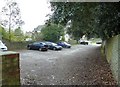
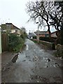
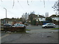
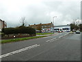
Photos of BN12 4JR


Area Information
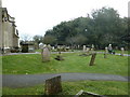
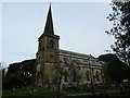
Living in BN12 4JR means residing within Goring Ward, a coastal neighbourhood inside the Worthing district in West Sussex. This specific postcode covers a small residential cluster spanning 2,367 square metres, one of the most compact settlements in the region. The area supports a population of 1,567 people across a very small footprint, creating a dense and intimate setting. historically, the parish was abolished in 1929 and merged with Worthing borough, retaining the character of a suburban coastal location west of the town centre. The neighbourhood is defined by its proximity to a mixed pebble and sand beach and the nearby Goring Gap protected area. You will find yourself located about 2.5 miles from Worthing town centre, placing you in a position to access both seaside relaxation and urban convenience. The land here includes estates like Maybridge and areas that extend towards West Durrington. Life revolves around the A259, a major east-west artery that links Brighton, Littlehampton, and Bognor Regis. This postcode offers a distinct blend of historic charm, such as the proximity to St Mary's Church, and modern infrastructure. Whether you seek the quiet of Titnore Wood or the activity of the local promenade, BN12 4JR provides immediate access to these varied settings without the need for long commutes.
- Area Type
- Postcode
- Area Size
- 2367 m²
- Population
- Not available
- Population Density
- Not available
Homes in BN12 4JR represent a secure investment within a market characterised by high stability. The accommodation type is exclusively houses, meaning you will not find purpose-built apartments or flats in this specific cluster. This homogeneity suggests that buyers are looking for detached or semi-detached properties with traditional English suburban features. With 92% home ownership, the area functions as a settled residential hub where existing owners stay put rather than cycling frequently into the sale market. This environment can make it challenging for first-time buyers to compete against established households, but it ensures the neighbourhood retains its original character. The property stock includes historic elements, with the area containing notable features like Goring Hall, now a healthcare facility, and Courtlands from the 1820s. Although the core of old Goring was demolished over 50 years ago, the current housing reflects post-1929 development and later expansions following 1938 railway electrification. For those seeking to buy, this postcode offers entry into a low-density, owner-occupied zone where redevelopment pressure is minimal compared to urban centres. The market here rewards patience and deep pockets, offering buyers a slice of the Goring estate that dates back to the pre-1939 garden city style.
House Prices in BN12 4JR
Showing 6 properties
| Address | Type | Beds | Baths | Last Sale Price | Last Sale Date | |
|---|---|---|---|---|---|---|
| 34A Nutley Drive, Goring, Worthing, BN12 4JR | Flat | 2 | 1 | £198,000 | Jan 2015 | |
| 34 Nutley Drive, Goring, Worthing, BN12 4JR | Flat | - | - | £222,000 | Jan 2015 | |
| 30 Nutley Drive, Goring, Worthing, BN12 4JR | house | - | - | £175,000 | Jun 2000 | |
| 36 Nutley Drive, Goring, Worthing, BN12 4JR | Detached | 3 | - | £129,950 | Nov 1997 | |
| 32 Nutley Drive, Goring, Worthing, BN12 4JR | Semi-detached | - | - | £110,000 | Jan 1996 | |
| Annexe, 30 Nutley Drive, Goring, Worthing, BN12 4JR | Flat | - | - | - | - |
Energy Efficiency in BN12 4JR
Daily life in BN12 4JR centres on a blend of coastal leisure and suburban convenience. You have immediate access to five retail outlets within practical reach, including Sainsburys Goring, Tesco Goring, and Budgens Boxgrove. These supermarkets support your weekly shopping needs without requiring a drive further into the town. Beyond essentials, the area offers five railway stations nearby, facilitating easy trips to Brighton or London. Leisure options abound with two airports close by, and the area borders the Goring Gap protected area for nature walks. The beach itself hosts popular watersports like kitesurfing, adding an active dimension to the lifestyle. Historic sites such as St Mary's Church and The Bull's Head pub add cultural depth, with the pub having operated since at least 1770. Highdown Gardens and Titnore Wood provide green spaces for relaxation. The Goring Hall estate project influences the local feel, though the building now houses a hospital. Residents enjoy a garden city-style atmosphere with ancient holm oaks lining the avenue to the church. Shopping, dining, and recreation are all integrated into a compact layout that reduces travel times. The presence of the A259 ensures quick access to wider networks, yet the heart of life remains in this accessible, amenity-rich pocket of West Sussex.
Amenities
Schools
| Rank | School | Type | Entry gender | Ages |
|---|
Explore more schools in this area
Go to Schools tabDemographics
The community within BN12 4JR is defined by a mature population where 92% of residents own their homes. This statistic indicates a stable, settled environment where long-term ownership is the norm rather than renting. The area primarily accommodates houses, reflecting the preference for single-family dwellings over apartments or flats. Residents in this ward are predominantly White and fall into the adult age bracket, with a median age of 47 years. Data confirms that adults between 30 and 64 years constitute the most common age range, suggesting a workforce-active demographic with disposable income. High home ownership rates often correlate with disposable income levels and investment in local property stability. The population density reaches 661,962 people per square kilometre within this specific small postcode, creating a very concentrated residential cluster. This density, combined with the absence of significant deprivation indicators, points to an affluent suburb where property values remain robust. Families and professionals settle here consistently, knowing that the housing stock remains largely unchanged by rapid turnover or speculative renting. The demographic profile supports a quiet, neighbourhood-focused lifestyle rather than a transient or student-heavy district.
Household Size
Accommodation Type
Tenure
Ethnic Group
Religion
Household Composition
Age
Household Deprivation
NS-SEC
Explore more demographic insights in this area
Go to Demographics tabPlanning
Planning Constraints
- Flood RiskPremium
- Ramsar Wetland SitesPremium
- Area of Outstanding Natural BeautyPremium
- Protected Nature ReservePremium
- Protected WoodlandPremium