Area Overview for BN1 9SN
Photos of BN1 9SN
Area Information
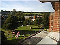
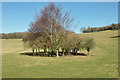
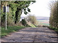
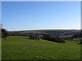
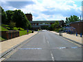
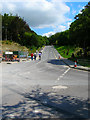
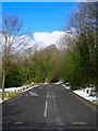
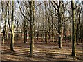
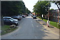
BN1 9SN lies in Coldean, a quiet suburban area in northeast Brighton and Hove, England. This small postcode covers 5,764 square metres and is home to 4,165 residents, making it a densely populated yet low-density neighbourhood. Developed as a postwar council estate from 1950 onwards, the area features semi-detached housing built to follow the valley’s contours, creating a secluded feel. Its steep wooded sides and proximity to Stanmer Park offer a peaceful contrast to Brighton’s bustling centres. Residents benefit from nearby rail links, including Falmer and Moulsecoomb stations, and regular bus routes along Lewes Road. The area’s character is defined by its garden suburb layout, with a mix of local amenities and access to the city’s cultural and educational hubs. For those seeking a balance between suburban tranquillity and urban connectivity, BN1 9SN provides a compact, well-served environment.
- Area Type
- Postcode
- Area Size
- 5764 m²
- Population
- 4165
- Population Density
- 1271 people/km²
The property market in BN1 9SN is characterised by owner-occupied homes, with 53% of properties in private hands. The area is dominated by houses rather than flats, reflecting its suburban, garden-style development. Semi-detached housing follows the valley’s natural topography, creating a distinct architectural identity. Given the postcode’s small size and limited housing stock, the market is likely constrained, with limited scope for new builds. Buyers should consider the area’s proximity to Brighton’s city centre, where larger property options may be more abundant. The mix of older postwar housing and newer developments suggests a stable market, though the small size of BN1 9SN means competition for available properties could be fierce.
House Prices in BN1 9SN
No properties found in this postcode.
Energy Efficiency in BN1 9SN
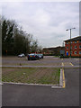
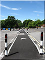
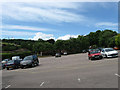
BN1 9SN offers a range of amenities within practical reach, including retail options like The Southern Co-operative Co, Asda Brighton, and M&S Carden Av Brighton. The area’s proximity to Stanmer Park provides green space for recreation, while nearby villages and Brighton’s city centre offer additional leisure and dining choices. The presence of Varley Halls, a student accommodation block, and a branch library on Beatty Avenue caters to both residents and students. The low-density layout and access to nature create a relaxed lifestyle, with shops, transport, and open spaces all within easy reach.
Amenities
Schools
The nearest educational institution to BN1 9SN is the University of Sussex, though it is categorised as an ‘other’ type and no specific school ratings are provided. No primary or secondary schools are listed in the data, meaning families may need to look beyond the immediate area for local schooling options. The absence of named schools suggests a reliance on nearby districts like Stanmer or Brighton for education. For those prioritising proximity to educational institutions, the area’s connection to the University of Sussex could be a draw, though it may not meet the needs of families requiring schools for younger children.
| Rank | School | Type | Entry gender | Ages |
|---|
Explore more schools in this area
Go to Schools tabDemographics
BN1 9SN has a median age of 22, with the majority of residents aged 15–29, reflecting a young adult demographic. Over half (53%) of homes are owner-occupied, while the remaining properties are likely rented, though specific rental data is not provided. The area is predominantly composed of houses, not flats, aligning with its low-density suburban design. The predominant ethnic group is White, though no further breakdown of diversity is available. With a population density of 1,271 people per square kilometre, the area is compact yet retains a sense of space. The young age profile suggests a community of students, graduates, and young professionals, many of whom may be linked to nearby institutions like the University of Sussex. This demographic shape influences local amenities, with services tailored to younger residents.
Household Size
Accommodation Type
Tenure
Ethnic Group
Religion
Household Composition
Age
Household Deprivation
NS-SEC
Explore more demographic insights in this area
Go to Demographics tabPlanning
Planning Constraints
- Flood RiskPremium
- Ramsar Wetland SitesPremium
- Area of Outstanding Natural BeautyPremium
- Protected Nature ReservePremium
- Protected WoodlandPremium