Area Overview for BN1 9QN
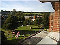
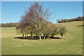
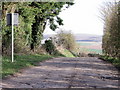
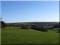
Photos of BN1 9QN
Area Information
BN1 9QN is a small, tightly knit residential cluster in Coldean, a suburb of Brighton and Hove. Covering 4,622 square metres, it is home to 4,165 people, with a population density of 1,271 per square kilometre. The area was developed as a postwar council estate by Brighton Corporation from 1950, addressing housing shortages in a valley bordered by steep wooded slopes. Today, it retains a low-density, suburban character with semi-detached homes that follow the valley’s contours. The community is predominantly young adults, with a median age of 22, reflecting a mix of students and early-career professionals. Proximity to Brighton offers easy access to cultural and employment hubs, while the area’s isolation within the valley fosters a quiet, residential atmosphere. With a crime risk score of 82 (low) and no significant environmental constraints, BN1 9QN balances practicality with a sense of security. Its small size and historical roots make it distinct, offering a blend of postwar architecture and modern amenities.
- Area Type
- Postcode
- Area Size
- 4622 m²
- Population
- 4165
- Population Density
- 1271 people/km²
BN1 9QN’s property market is characterised by semi-detached houses, with a strong emphasis on owner-occupation (53%). The area’s small size and postwar development mean housing stock is limited, but the valley’s natural contours have preserved a low-density, garden-style suburb. While the data does not specify property prices, the mix of home ownership and rental availability suggests a balanced market. The presence of student housing, such as Varley Halls, indicates a secondary demand from university populations. For buyers, the area’s proximity to Brighton offers access to a broader housing market, though BN1 9QN itself is best suited for those seeking a quiet, residential setting with minimal urban congestion. The lack of high-rise buildings or commercial developments reinforces its appeal to families and professionals seeking a peaceful, compact community.
House Prices in BN1 9QN
Showing 3 properties
| Address | Type | Beds | Baths | Last Sale Price | Last Sale Date | |
|---|---|---|---|---|---|---|
| Park Village Bar, Arts Building B, Arts Road, University Of Sussex, Brighton, BN1 9QN | pub | - | - | - | - | |
| Downs Restaurant, Arts Building B, Arts Road, University Of Sussex, Brighton, BN1 9QN | Restaurant | - | - | - | - | |
| Former School Of English And American Studies, Arts Building B, Arts Road, University Of Sussex, Brighton, BN1 9QN | commercial | - | - | - | - |
Energy Efficiency in BN1 9QN
Residents of BN1 9QN enjoy a range of amenities within practical reach. Retail options include The Southern Co-operative Co, Asda Brighton, and M&S Carden Av Brighton, offering everyday shopping needs. The area’s proximity to Stanmer Park and the historic Stanmer village provides opportunities for outdoor recreation and cultural engagement. Within the postcode, a junior school, branch library, and local shops contribute to a self-contained lifestyle. The valley’s wooded slopes and suburban layout create a peaceful environment, while the nearby University of Sussex adds a layer of academic and cultural activity. The mix of retail, green spaces, and transport links ensures convenience without the density of central Brighton, making it appealing to those seeking balance between accessibility and tranquillity.
Amenities
Schools
The nearest educational institution to BN1 9QN is the University of Sussex, a higher education provider. However, the data does not list primary or secondary schools in the immediate vicinity, meaning families may need to look beyond the postcode for schools. The absence of local schools contrasts with the presence of a junior school on Selham Drive, which is part of the broader Coldean & Stanmer Ward. This suggests that while higher education is accessible, primary and secondary schooling may require commuting to nearby areas such as Brighton or Stanmer. The mix of educational institutions reflects the area’s role as a residential suburb rather than a standalone educational hub.
| Rank | School | Type | Entry gender | Ages |
|---|
Explore more schools in this area
Go to Schools tabDemographics
BN1 9QN’s population skews heavily toward young adults, with 15–29-year-olds making up the most common age range. The median age of 22 suggests a community dominated by students, graduates, and young professionals. Home ownership stands at 53%, indicating a mix of owner-occupied properties and rental stock. The accommodation type is primarily houses, with semi-detached homes forming the majority. The predominant ethnic group is White, reflecting broader demographic trends in the area. While the data does not specify deprivation levels, the high proportion of young residents and the presence of student housing—such as Varley Halls at the University of Brighton—suggest a transient population. This dynamic community prioritises affordability and accessibility, with proximity to Brighton’s amenities shaping daily life. The low population density and suburban layout further contribute to a relaxed, low-traffic environment.
Household Size
Accommodation Type
Tenure
Ethnic Group
Religion
Household Composition
Age
Household Deprivation
NS-SEC
Explore more demographic insights in this area
Go to Demographics tabPlanning
Planning Constraints
- Flood RiskPremium
- Ramsar Wetland SitesPremium
- Area of Outstanding Natural BeautyPremium
- Protected Nature ReservePremium
- Protected WoodlandPremium