Area Overview for BN1 6AL
Photos of BN1 6AL
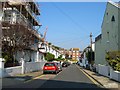
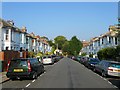
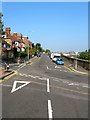
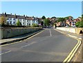
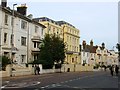
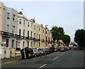
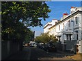
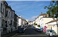
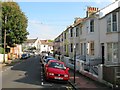
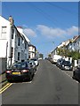
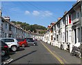
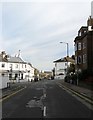
100 photos from this area
Area Information
Key information about the BN1 6AL including its size, population, and administrative classification.
- Area Type
- Postcode
- Area Size
- 2.1 hectares
- Population
- 1810
- Population Density
- 7949 people/km²
House Prices in BN1 6AL
18
Properties
£445,000
Average Sold Price
£156,000
Lowest Price
£652,000
Highest Price
Showing 18 properties
| Address | Type | Beds | Baths | Last Sale Price | Last Sale Date | |
|---|---|---|---|---|---|---|
| 15 Parkmore Terrace, Brighton, BN1 6AL | house | - | - | £608,000 | Aug 2022 | |
| 16 Parkmore Terrace, Brighton, BN1 6AL | house | 4 | 2 | £652,000 | Jun 2022 | |
| 3 Parkmore Terrace, Brighton, BN1 6AL | Terraced | 6 | 2 | £500,000 | Mar 2022 | |
| 8 Parkmore Terrace, Brighton, BN1 6AL | Terraced | 4 | 1 | £600,000 | Apr 2021 | |
| 12 Parkmore Terrace, Brighton, BN1 6AL | Terraced | 3 | 1 | £525,000 | Dec 2017 | |
| 13 Parkmore Terrace, Brighton, BN1 6AL | house | - | - | £520,000 | Jun 2017 | |
| 6 Parkmore Terrace, Brighton, BN1 6AL | Terraced | 4 | - | £465,000 | Dec 2013 | |
| 2 Parkmore Terrace, Brighton, BN1 6AL | house | 4 | - | £475,000 | Aug 2012 | |
| 10 Parkmore Terrace, Brighton, BN1 6AL | house | - | - | £205,000 | Jan 2003 | |
| 4 Parkmore Terrace, Brighton, BN1 6AL | house | - | - | £156,000 | Aug 2001 |
Page 1 of 2
Energy Efficiency in BN1 6AL
Amenities
Schools
| Rank | School | Type | Entry gender | Ages |
|---|
Explore more schools in this area
Go to Schools tabDemographics
Household Size
Two person
most common
Accommodation Type
Houses
most common
Tenure
58
majority
Ethnic Group
White
most common
Religion
N/A
most common
Household Composition
N/A
most common
Age
47
median
Adults (30-64 years)
most common
Household Deprivation
N/A
with no deprivation
NS-SEC
51
in Lower managerial occupations
Explore more demographic insights in this area
Go to Demographics tabPlanning
Planning Constraints
- Flood RiskPremium
- Ramsar Wetland SitesPremium
- Area of Outstanding Natural BeautyPremium
- Protected Nature ReservePremium
- Protected WoodlandPremium