Area Overview for BN1 4QA
Photos of BN1 4QA
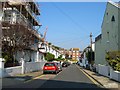
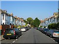
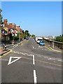
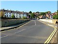
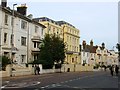
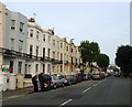
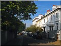
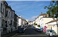
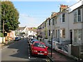
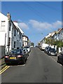
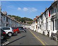
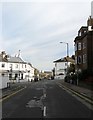
100 photos from this area
Area Information
Key information about the BN1 4QA including its size, population, and administrative classification.
- Area Type
- Postcode
- Area Size
- 1.6 hectares
- Population
- 1810
- Population Density
- 7949 people/km²
House Prices in BN1 4QA
49
Properties
£367,212
Average Sold Price
£64,000
Lowest Price
£650,000
Highest Price
Showing 49 properties
| Address | Type | Beds | Baths | Last Sale Price | Last Sale Date | |
|---|---|---|---|---|---|---|
| 4 Argyle Road, Brighton, BN1 4QA | house | 3 | 2 | £612,000 | Mar 2025 | |
| 25 Argyle Road, Brighton, BN1 4QA | Terraced | 3 | 1 | £616,000 | Aug 2023 | |
| 24 Argyle Road, Brighton, BN1 4QA | house | - | - | £476,000 | Mar 2022 | |
| 5 Argyle Road, Brighton, BN1 4QA | house | 6 | - | £595,000 | Oct 2021 | |
| 21 Argyle Road, Brighton, BN1 4QA | Terraced | 6 | 6 | £435,000 | Apr 2021 | |
| 11 Argyle Road, Brighton, BN1 4QA | house | - | - | £475,000 | Mar 2021 | |
| 12 Argyle Road, Brighton, BN1 4QA | Terraced | 3 | 1 | £515,000 | May 2020 | |
| 16 Argyle Road, Brighton, BN1 4QA | house | - | - | £650,000 | May 2019 | |
| 20 Argyle Road, Brighton, BN1 4QA | Terraced | 6 | 6 | £385,000 | Dec 2016 | |
| 23 Argyle Road, Brighton, BN1 4QA | house | - | - | £505,000 | Feb 2016 |
Page 1 of 5
Energy Efficiency in BN1 4QA
Amenities
Schools
| Rank | School | Type | Entry gender | Ages |
|---|
Explore more schools in this area
Go to Schools tabDemographics
Household Size
Two person
most common
Accommodation Type
Houses
most common
Tenure
58
majority
Ethnic Group
White
most common
Religion
N/A
most common
Household Composition
N/A
most common
Age
47
median
Adults (30-64 years)
most common
Household Deprivation
N/A
with no deprivation
NS-SEC
51
in Lower managerial occupations
Explore more demographic insights in this area
Go to Demographics tabPlanning
Planning Constraints
- Flood RiskPremium
- Ramsar Wetland SitesPremium
- Area of Outstanding Natural BeautyPremium
- Protected Nature ReservePremium
- Protected WoodlandPremium