Area Overview for Tilehurst
Photos of Tilehurst

Area Information
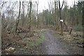
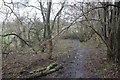
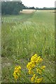
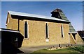
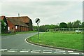
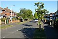
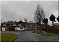
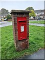
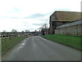
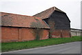
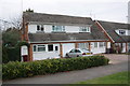
Tilehurst is a village on the outskirts of Reading, Berkshire, distinct for maintaining a strong village identity despite being located just three miles west of the town centre. You will find the area spans 6.3 km² and sits on a hill bounded by the River Thames to the north and the River Kennet to the south. The community operates with the feel of a traditional English village, centred around Tilehurst Triangle, a pedestrianised area that serves as the local focal point featuring a village green and war memorial. This setting offers a quiet residential atmosphere while remaining conveniently close to major urban amenities. Historically, the name Tilehurst reflects its origins in a wooded hill used for brick and tile production, an industry that thrived from the mid-1600s until the mid-1960s. The arrival of the railway in the 20th century transformed the settlement into a commuter spot, yet the historic church founded by 1189 and surviving Tudor timber-framed buildings testify to its longer existence. Today, the architecture is a mix of turn-of-the-century cottages, Victorian and Edwardian terraces, and late 20th-century estates. Residents enjoy native access to Prospect Park and Arthur Newbery Park, areas of open space and woodland walks that define the neighbourhood's character. Living in Tilehurst means balancing suburban convenience with the quiet retreat of a historian's village, offering views across the Thames Valley and a high street lined with local businesses.
- Area Type
- Parish
- Area Size
- 6.3 km²
- Population
- Not available
- Population Density
- Not available
Demographics
The community profile in Tilehurst reveals an exceptionally older population compared to the national average. The median age is 70, indicating that a significant portion of residents are retirees or older adults choosing a quieter lifestyle. Most households comprise individuals or empty nesters rather than families with young children. You will find that 83% of homes are owner-occupied, which creates a stable, established neighbourhood where residents have deep roots. This high level of ownership correlates with the area's reputation for safety and low crime rates. The demographic data suggests a lack of transient population, with few rental properties recorded in the area. This stability often means neighbours know each other, fostering the close-knit community spirit noted by local observers. While the majority of the population falls into the older age bracket, the area remains affordable enough for some downsizing families. There is no specific data on ethnic diversity or religious breakdown available in the current records, so the focus remains on the age and ownership structure. The dominance of older, owner-occupied homes means you are likely to encounter long-term residents who have lived here since the commuting era. This age profile also aligns with the architectural stock, where many properties suit older living habits rather than a dense, young-professional marketplace.
Household Size
Accommodation Type
Tenure
Ethnic Group
Religion
Household Composition
Age
Household Deprivation
NS-SEC
Explore more demographic insights in this area
Go to Demographics tabPlanning
Planning Constraints
- Flood RiskPremium
- Ramsar Wetland SitesPremium
- Area of Outstanding Natural BeautyPremium
- Protected Nature ReservePremium
- Protected WoodlandPremium