Area Overview for Bucklebury
Photos of Bucklebury


Area Information
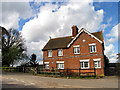
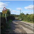
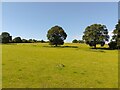
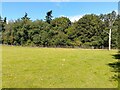
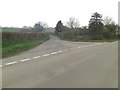
Living in Bucklebury means residing in a compact district that covers 21.8 square kilometres within the county of Berkshire. The area functions as a settled ward with a distinct character defined by its low population density and established residential footprint. Daily life here revolves around a quiet, suburban pace without the chaotic rhythms of dense urban centres. Prospective residents will find a environment where personal space is prioritised, yet essential amenities are accessible. The location serves as a practical base for those seeking a balance between privacy and proximity to wider regional services. You can expect a neighbourhood that has developed organically over decades, resulting in a stable community setting. The physical layout supports a lifestyle centred on local amenities rather than sprawling transit networks. This ward offers a defined sense of place where boundaries are clear and the scale is manageable. Families and individuals looking for established surroundings will find Bucklebury provides a clear, organised structure for their home life. The area's size accommodates a variety of housing types while maintaining a cohesive overall identity.
- Area Type
- Parish
- Area Size
- 21.8 km²
- Population
- Not available
- Population Density
- Not available
Demographics
The community within Bucklebury is defined by an exceptionally older population profile. Residents here average a median age of 70, indicating that the primary demographic consists of retirees or older generations. This age structure shapes the social fabric and suggests a clientele with ample time for leisure activities and community engagement. Household composition reflects a preference for stability rather than transient living arrangements. You will find that 77% of the local population own their homes outright, creating a highly stable ownership base. This high rate of tenure contrasts sharply with areas reliant on rental markets. The accommodation stock predominantly caters to established needs rather than entry-level requirements. While specific breakdowns for ethnic groups, religious affiliations, and detailed household compositions are not listed in current reports, the dominant age factor remains the clearest demographic marker. This concentration of older residents influences local spending habits, service demand, and the pace of community interaction. Those considering homes in Bucklebury should understand they are entering an environment where long-term settlement is the norm.
Household Size
Accommodation Type
Tenure
Ethnic Group
Religion
Household Composition
Age
Household Deprivation
NS-SEC
Explore more demographic insights in this area
Go to Demographics tabPlanning
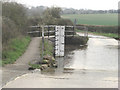
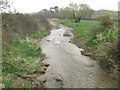
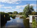
Planning Constraints
- Flood RiskPremium
- Ramsar Wetland SitesPremium
- Area of Outstanding Natural BeautyPremium
- Protected Nature ReservePremium
- Protected WoodlandPremium