Area Overview for WN8 0AG
Photos of WN8 0AG

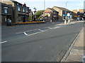
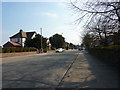
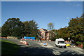
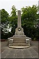
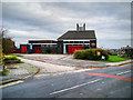
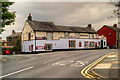
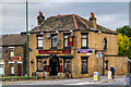
32 photos from this area
Area Information
Key information about the WN8 0AG including its size, population, and administrative classification.
- Area Type
- Postcode
- Area Size
- 8855 m²
- Population
- 1452
- Population Density
- 5463 people/km²
House Prices in WN8 0AG
16
Properties
£103,889
Average Sold Price
£70,500
Lowest Price
£138,500
Highest Price
Showing 16 properties
| Address | Type | Beds | Baths | Last Sale Price | Last Sale Date | |
|---|---|---|---|---|---|---|
| 14 Ormskirk Road, Up Holland, WN8 0AG | house | - | - | £138,500 | Apr 2025 | |
| 38 Ormskirk Road, Up Holland, WN8 0AG | Terraced | 2 | 1 | £111,000 | Feb 2024 | |
| 18 Ormskirk Road, Up Holland, WN8 0AG | house | - | - | £120,000 | Mar 2023 | |
| 8 Ormskirk Road, Up Holland, WN8 0AG | Terraced | 2 | 1 | £100,000 | Jan 2022 | |
| 10 Ormskirk Road, Up Holland, WN8 0AG | Terraced | 2 | 1 | £90,000 | Sep 2018 | |
| 42 Ormskirk Road, Up Holland, WN8 0AG | house | 2 | - | £85,000 | Mar 2011 | |
| 12 Ormskirk Road, Up Holland, WN8 0AG | house | - | - | £95,000 | Feb 2010 | |
| 36 Ormskirk Road, Up Holland, WN8 0AG | Terraced | - | - | £125,000 | Nov 2007 | |
| 40 Ormskirk Road, Up Holland, WN8 0AG | Terraced | - | - | £70,500 | Oct 2002 | |
| Barn Lodge Veterinary Centre, 46 Ormskirk Road, Up Holland, WN8 0AG | commercial | - | - | - | - |
Page 1 of 2
Energy Efficiency in WN8 0AG
Amenities
Schools
| Rank | School | Type | Entry gender | Ages |
|---|
Explore more schools in this area
Go to Schools tabDemographics
Household Size
Two person
most common
Accommodation Type
Houses
most common
Tenure
52
majority
Ethnic Group
White
most common
Religion
N/A
most common
Household Composition
N/A
most common
Age
47
median
Adults (30-64 years)
most common
Household Deprivation
N/A
with no deprivation
NS-SEC
24
in Lower managerial occupations
Explore more demographic insights in this area
Go to Demographics tabPlanning
Planning Constraints
- Flood RiskPremium
- Ramsar Wetland SitesPremium
- Area of Outstanding Natural BeautyPremium
- Protected Nature ReservePremium
- Protected WoodlandPremium