Area Overview for WN8 0EN
Photos of WN8 0EN

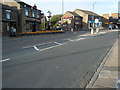
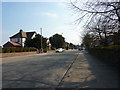
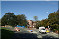

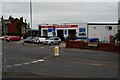

32 photos from this area
Area Information
Key information about the WN8 0EN including its size, population, and administrative classification.
- Area Type
- Postcode
- Area Size
- 2.3 hectares
- Population
- 1226
- Population Density
- 235 people/km²
House Prices in WN8 0EN
38
Properties
£142,770
Average Sold Price
£250
Lowest Price
£624,500
Highest Price
Showing 38 properties
| Address | Type | Beds | Baths | Last Sale Price | Last Sale Date | |
|---|---|---|---|---|---|---|
| 30 Dingle Road, Up Holland, WN8 0EN | Detached | 3 | 1 | £254,950 | Oct 2025 | |
| 41 Dingle Road, Up Holland, WN8 0EN | Terraced | 3 | 2 | £108,000 | Mar 2025 | |
| 43 Dingle Road, Up Holland, WN8 0EN | Semi-detached | 4 | 2 | £280,000 | Mar 2025 | |
| 33 Dingle Road, Up Holland, WN8 0EN | Terraced | 2 | 1 | £150,000 | Jul 2024 | |
| 5A Dingle Road, Up Holland, WN8 0EN | Maisonette | 2 | 1 | £58,000 | Jun 2023 | |
| 19 Dingle Road, Up Holland, WN8 0EN | Semi-detached | 2 | 1 | £207,450 | Feb 2023 | |
| Hallbridge Farm House, 59 Dingle Road, Up Holland, WN8 0EN | Detached | 2 | 2 | £624,500 | Oct 2022 | |
| 37 Dingle Road, Up Holland, WN8 0EN | Terraced | 2 | 1 | £94,000 | Feb 2020 | |
| 31 Dingle Road, Up Holland, WN8 0EN | Terraced | 2 | 1 | £95,000 | Jul 2019 | |
| 34 Dingle Road, Up Holland, WN8 0EN | Semi-detached | 4 | - | £173,500 | Feb 2017 |
Page 1 of 4
Energy Efficiency in WN8 0EN
Amenities
Schools
| Rank | School | Type | Entry gender | Ages |
|---|
Explore more schools in this area
Go to Schools tabDemographics
Household Size
Two person
most common
Accommodation Type
Houses
most common
Tenure
85
majority
Ethnic Group
White
most common
Religion
N/A
most common
Household Composition
N/A
most common
Age
47
median
Adults (30-64 years)
most common
Household Deprivation
N/A
with no deprivation
NS-SEC
42
in Lower managerial occupations
Explore more demographic insights in this area
Go to Demographics tabPlanning
Planning Constraints
- Flood RiskPremium
- Ramsar Wetland SitesPremium
- Area of Outstanding Natural BeautyPremium
- Protected Nature ReservePremium
- Protected WoodlandPremium