Area Overview for WN5 8SY
Photos of WN5 8SY


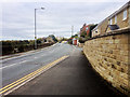
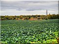
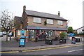
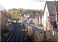
33 photos from this area
Area Information
Key information about the WN5 8SY including its size, population, and administrative classification.
- Area Type
- Postcode
- Area Size
- 7021 m²
- Population
- 2266
- Population Density
- 4061 people/km²
House Prices in WN5 8SY
28
Properties
£120,161
Average Sold Price
£350
Lowest Price
£340,000
Highest Price
Showing 28 properties
| Address | Type | Beds | Baths | Last Sale Price | Last Sale Date | |
|---|---|---|---|---|---|---|
| 14 St James Road, Orrell, WN5 8SY | Terraced | 2 | 1 | £133,500 | Nov 2024 | |
| 50 St James Road, Orrell, WN5 8SY | Terraced | 2 | 1 | £185,000 | Apr 2024 | |
| 8 St James Road, Orrell, WN5 8SY | Terraced | 2 | 1 | £137,000 | Oct 2023 | |
| 24 St James Road, Orrell, WN5 8SY | Terraced | 2 | 1 | £150,000 | Aug 2023 | |
| 58 St James Road, Orrell, WN5 8SY | Terraced | 3 | 1 | £192,000 | Mar 2023 | |
| 52 St James Road, Orrell, WN5 8SY | Terraced | 2 | 1 | £170,000 | Feb 2023 | |
| 4 St James Road, Orrell, WN5 8SY | Terraced | 2 | 1 | £133,500 | Oct 2022 | |
| 28 St James Road, Orrell, WN5 8SY | house | 4 | 1 | £340,000 | Jun 2022 | |
| 54 St James Road, Orrell, WN5 8SY | Terraced | 3 | 2 | £163,000 | May 2021 | |
| 32 St James Road, Orrell, WN5 8SY | Terraced | 2 | 1 | £130,000 | Dec 2019 |
Page 1 of 3
Energy Efficiency in WN5 8SY
Amenities
Schools
| Rank | School | Type | Entry gender | Ages |
|---|
Explore more schools in this area
Go to Schools tabDemographics
Household Size
Family (3-5 people)
most common
Accommodation Type
Houses
most common
Tenure
86
majority
Ethnic Group
White
most common
Religion
N/A
most common
Household Composition
N/A
most common
Age
47
median
Adults (30-64 years)
most common
Household Deprivation
N/A
with no deprivation
NS-SEC
43
in Lower managerial occupations
Explore more demographic insights in this area
Go to Demographics tabPlanning
Planning Constraints
- Flood RiskPremium
- Ramsar Wetland SitesPremium
- Area of Outstanding Natural BeautyPremium
- Protected Nature ReservePremium
- Protected WoodlandPremium