Area Overview for WN5 7AL
Photos of WN5 7AL
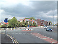
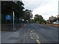
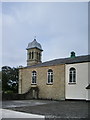

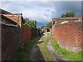
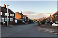
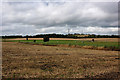
38 photos from this area
Area Information
Key information about the WN5 7AL including its size, population, and administrative classification.
- Area Type
- Postcode
- Area Size
- 6.6 hectares
- Population
- 1537
- Population Density
- 1118 people/km²
House Prices in WN5 7AL
22
Properties
£195,231
Average Sold Price
£74,000
Lowest Price
£354,000
Highest Price
Showing 22 properties
| Address | Type | Beds | Baths | Last Sale Price | Last Sale Date | |
|---|---|---|---|---|---|---|
| 120 Sandbrook Road, Up Holland, WN5 7AL | Terraced | 2 | 1 | £162,000 | Oct 2024 | |
| 73 Sandbrook Road, Up Holland, WN5 7AL | Detached | 5 | 2 | £348,000 | Mar 2023 | |
| 114 Sandbrook Road, Up Holland, WN5 7AL | Retail | 2 | 1 | £155,750 | Jun 2022 | |
| 77 Sandbrook Road, Up Holland, WN5 7AL | house | - | - | £275,000 | Apr 2021 | |
| 81 Sandbrook Road, Up Holland, WN5 7AL | Bungalow | - | - | £240,000 | Nov 2019 | |
| 128 Sandbrook Road, Up Holland, WN5 7AL | Detached | 4 | 1 | £218,500 | Dec 2017 | |
| 91 Sandbrook Road, Up Holland, WN5 7AL | house | - | - | £354,000 | Nov 2017 | |
| 110 Sandbrook Road, Up Holland, WN5 7AL | Bungalow | 3 | 1 | £175,000 | May 2016 | |
| 118 Sandbrook Road, Up Holland, WN5 7AL | house | - | - | £122,500 | Jun 2011 | |
| 83 Sandbrook Road, Up Holland, WN5 7AL | Bungalow | - | - | £172,500 | Jan 2008 |
Page 1 of 3
Energy Efficiency in WN5 7AL
Amenities
Schools
| Rank | School | Type | Entry gender | Ages |
|---|
Explore more schools in this area
Go to Schools tabDemographics
Household Size
Two person
most common
Accommodation Type
Houses
most common
Tenure
80
majority
Ethnic Group
White
most common
Religion
N/A
most common
Household Composition
N/A
most common
Age
47
median
Adults (30-64 years)
most common
Household Deprivation
N/A
with no deprivation
NS-SEC
36
in Lower managerial occupations
Explore more demographic insights in this area
Go to Demographics tabPlanning
Planning Constraints
- Flood RiskPremium
- Ramsar Wetland SitesPremium
- Area of Outstanding Natural BeautyPremium
- Protected Nature ReservePremium
- Protected WoodlandPremium