Area Overview for WN5 7AA
Photos of WN5 7AA
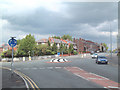
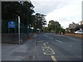
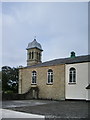


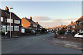
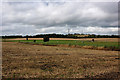
38 photos from this area
Area Information
Key information about the WN5 7AA including its size, population, and administrative classification.
- Area Type
- Postcode
- Area Size
- 6.3 hectares
- Population
- 2266
- Population Density
- 4061 people/km²
House Prices in WN5 7AA
35
Properties
£216,787
Average Sold Price
£66,000
Lowest Price
£535,000
Highest Price
Showing 35 properties
| Address | Type | Beds | Baths | Last Sale Price | Last Sale Date | |
|---|---|---|---|---|---|---|
| 132 St James Road, Orrell, WN5 7AA | Semi-detached | 4 | 2 | £345,000 | Jun 2024 | |
| 82 St James Road, Orrell, WN5 7AA | Terraced | 3 | 1 | £180,000 | Jul 2023 | |
| 94 St James Road, Orrell, WN5 7AA | Detached | 3 | 2 | £254,000 | Jul 2023 | |
| 108 St James Road, Orrell, WN5 7AA | Detached | 4 | 3 | £535,000 | Jan 2023 | |
| 128 St James Road, Orrell, WN5 7AA | Terraced | 3 | 1 | £165,000 | Dec 2020 | |
| 80B St James Road, Orrell, WN5 7AA | Bungalow | 3 | 1 | £230,000 | Dec 2019 | |
| 92 St James Road, Orrell, WN5 7AA | house | - | - | £139,000 | Oct 2017 | |
| 124 St James Road, Orrell, WN5 7AA | Terraced | 2 | 1 | £140,950 | Dec 2016 | |
| 136 St James Road, Orrell, WN5 7AA | Semi-detached | 3 | 1 | £170,000 | Jun 2016 | |
| 98 St James Road, Orrell, WN5 7AA | house | 4 | 4 | £277,500 | Jun 2015 |
Page 1 of 4
Energy Efficiency in WN5 7AA
Amenities
Schools
| Rank | School | Type | Entry gender | Ages |
|---|
Explore more schools in this area
Go to Schools tabDemographics
Household Size
Family (3-5 people)
most common
Accommodation Type
Houses
most common
Tenure
86
majority
Ethnic Group
White
most common
Religion
N/A
most common
Household Composition
N/A
most common
Age
47
median
Adults (30-64 years)
most common
Household Deprivation
N/A
with no deprivation
NS-SEC
43
in Lower managerial occupations
Explore more demographic insights in this area
Go to Demographics tabPlanning
Planning Constraints
- Flood RiskPremium
- Ramsar Wetland SitesPremium
- Area of Outstanding Natural BeautyPremium
- Protected Nature ReservePremium
- Protected WoodlandPremium