Area Overview for WN4 8AN
Photos of WN4 8AN


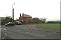
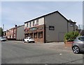
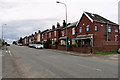
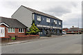
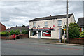


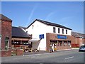
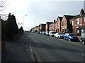

20 photos from this area
Area Information
Key information about the WN4 8AN including its size, population, and administrative classification.
- Area Type
- Postcode
- Area Size
- 1.1 hectares
- Population
- 1490
- Population Density
- 2738 people/km²
House Prices in WN4 8AN
25
Properties
£156,670
Average Sold Price
£54,000
Lowest Price
£283,750
Highest Price
Showing 25 properties
| Address | Type | Beds | Baths | Last Sale Price | Last Sale Date | |
|---|---|---|---|---|---|---|
| 476 Bryn Road, Ashton In Makerfield, WN4 8AN | Semi-detached | 3 | 2 | £280,000 | Dec 2024 | |
| 472 Bryn Road, Ashton In Makerfield, WN4 8AN | house | - | - | £283,750 | Dec 2022 | |
| 498 Bryn Road, Ashton In Makerfield, WN4 8AN | Semi-detached | 3 | 1 | £152,000 | Jun 2021 | |
| 464 Bryn Road, Ashton In Makerfield, WN4 8AN | Semi-detached | 3 | 1 | £185,000 | May 2018 | |
| 496 Bryn Road, Ashton In Makerfield, WN4 8AN | Semi-detached | 3 | 1 | £114,500 | Apr 2017 | |
| 484 Bryn Road, Ashton In Makerfield, WN4 8AN | house | - | - | £133,500 | May 2011 | |
| 494 Bryn Road, Ashton In Makerfield, WN4 8AN | Semi-detached | - | - | £144,950 | Dec 2007 | |
| 478 Bryn Road, Ashton In Makerfield, WN4 8AN | Semi-detached | - | - | £160,000 | Jul 2005 | |
| 480 Bryn Road, Ashton In Makerfield, WN4 8AN | Semi-detached | - | - | £59,000 | Mar 2000 | |
| 462 Bryn Road, Ashton In Makerfield, WN4 8AN | Semi-detached | 3 | - | £54,000 | Nov 1996 |
Page 1 of 3
Energy Efficiency in WN4 8AN
Amenities
Schools
| Rank | School | Type | Entry gender | Ages |
|---|
Explore more schools in this area
Go to Schools tabDemographics
Household Size
Two person
most common
Accommodation Type
Houses
most common
Tenure
94
majority
Ethnic Group
White
most common
Religion
N/A
most common
Household Composition
N/A
most common
Age
47
median
Adults (30-64 years)
most common
Household Deprivation
N/A
with no deprivation
NS-SEC
35
in Lower managerial occupations
Explore more demographic insights in this area
Go to Demographics tabPlanning
Planning Constraints
- Flood RiskPremium
- Ramsar Wetland SitesPremium
- Area of Outstanding Natural BeautyPremium
- Protected Nature ReservePremium
- Protected WoodlandPremium