Area Overview for WN4 8AL
Photos of WN4 8AL
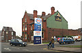

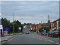


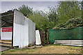


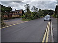
29 photos from this area
Area Information
Key information about the WN4 8AL including its size, population, and administrative classification.
- Area Type
- Postcode
- Area Size
- 3834 m²
- Population
- 1490
- Population Density
- 2738 people/km²
House Prices in WN4 8AL
16
Properties
£92,900
Average Sold Price
£24,500
Lowest Price
£145,500
Highest Price
Showing 16 properties
| Address | Type | Beds | Baths | Last Sale Price | Last Sale Date | |
|---|---|---|---|---|---|---|
| 95 Bryn Road South, Ashton In Makerfield, WN4 8AL | house | - | - | £125,000 | Jun 2024 | |
| 105 Bryn Road South, Ashton In Makerfield, WN4 8AL | house | - | - | £145,500 | Sep 2022 | |
| 107 Bryn Road South, Ashton In Makerfield, WN4 8AL | house | - | - | £119,995 | Oct 2021 | |
| 101 Bryn Road South, Ashton In Makerfield, WN4 8AL | house | 3 | - | £135,000 | Jan 2020 | |
| 103 Bryn Road South, Ashton In Makerfield, WN4 8AL | Terraced | 2 | 1 | £71,000 | Sep 2018 | |
| 91 Bryn Road South, Ashton In Makerfield, WN4 8AL | house | 3 | 3 | £116,000 | Mar 2016 | |
| 109 Bryn Road South, Ashton In Makerfield, WN4 8AL | house | - | - | £60,000 | May 2003 | |
| 111 Bryn Road South, Ashton In Makerfield, WN4 8AL | Detached | 4 | 1 | £92,000 | Nov 2002 | |
| 89 Bryn Road South, Ashton In Makerfield, WN4 8AL | house | - | - | £40,000 | Jan 2002 | |
| 85A Bryn Road South, Ashton In Makerfield, WN4 8AL | Bungalow | - | - | £24,500 | Nov 1996 |
Page 1 of 2
Energy Efficiency in WN4 8AL
Amenities
Schools
| Rank | School | Type | Entry gender | Ages |
|---|
Explore more schools in this area
Go to Schools tabDemographics
Household Size
Two person
most common
Accommodation Type
Houses
most common
Tenure
94
majority
Ethnic Group
White
most common
Religion
N/A
most common
Household Composition
N/A
most common
Age
47
median
Adults (30-64 years)
most common
Household Deprivation
N/A
with no deprivation
NS-SEC
35
in Lower managerial occupations
Explore more demographic insights in this area
Go to Demographics tabPlanning
Planning Constraints
- Flood RiskPremium
- Ramsar Wetland SitesPremium
- Area of Outstanding Natural BeautyPremium
- Protected Nature ReservePremium
- Protected WoodlandPremium