Area Overview for WA8 8UZ
Photos of WA8 8UZ

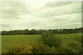
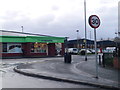
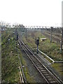
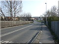
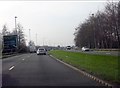
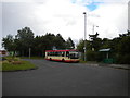
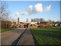
15 photos from this area
Area Information
Key information about the WA8 8UZ including its size, population, and administrative classification.
- Area Type
- Postcode
- Area Size
- 2.4 hectares
- Population
- 2142
- Population Density
- 360 people/km²
House Prices in WA8 8UZ
42
Properties
£128,675
Average Sold Price
£38,000
Lowest Price
£215,000
Highest Price
Showing 42 properties
| Address | Type | Beds | Baths | Last Sale Price | Last Sale Date | |
|---|---|---|---|---|---|---|
| 26 Heath View Road, Widnes, WA8 8UZ | Semi-detached | 2 | 1 | £165,000 | Dec 2024 | |
| 2 Heath View Road, Widnes, WA8 8UZ | Semi-detached | 3 | 1 | £195,000 | Mar 2024 | |
| 28 Heath View Road, Widnes, WA8 8UZ | house | - | - | £145,000 | Aug 2023 | |
| 24 Heath View Road, Widnes, WA8 8UZ | Semi-detached | 3 | 1 | £207,000 | Jun 2023 | |
| 29 Heath View Road, Widnes, WA8 8UZ | Bungalow | 2 | - | £215,000 | May 2023 | |
| 12 Heath View Road, Widnes, WA8 8UZ | Bungalow | 3 | 1 | £115,000 | Feb 2020 | |
| 30 Heath View Road, Widnes, WA8 8UZ | Bungalow | - | - | £145,000 | Jan 2020 | |
| 17 Heath View Road, Widnes, WA8 8UZ | Bungalow | - | - | £135,000 | Dec 2019 | |
| 9 Heath View Road, Widnes, WA8 8UZ | Bungalow | 2 | - | £146,000 | Mar 2018 | |
| 33 Heath View Road, Widnes, WA8 8UZ | Bungalow | - | - | £120,000 | Sep 2017 |
Page 1 of 5
Energy Efficiency in WA8 8UZ
Amenities
Schools
| Rank | School | Type | Entry gender | Ages |
|---|
Explore more schools in this area
Go to Schools tabDemographics
Household Size
One person
most common
Accommodation Type
Houses
most common
Tenure
58
majority
Ethnic Group
White
most common
Religion
N/A
most common
Household Composition
N/A
most common
Age
47
median
Adults (30-64 years)
most common
Household Deprivation
N/A
with no deprivation
NS-SEC
22
in Lower managerial occupations
Explore more demographic insights in this area
Go to Demographics tabPlanning
Planning Constraints
- Flood RiskPremium
- Ramsar Wetland SitesPremium
- Area of Outstanding Natural BeautyPremium
- Protected Nature ReservePremium
- Protected WoodlandPremium