Area Overview for WA5 1QW
Photos of WA5 1QW
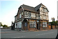
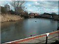
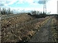

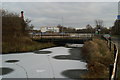
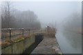

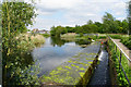

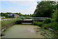
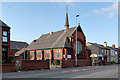
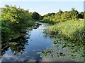
31 photos from this area
Area Information
Key information about the WA5 1QW including its size, population, and administrative classification.
- Area Type
- Postcode
- Area Size
- 6200 m²
- Population
- 1374
- Population Density
- 3511 people/km²
House Prices in WA5 1QW
14
Properties
£154,833
Average Sold Price
£53,000
Lowest Price
£260,000
Highest Price
Showing 14 properties
| Address | Type | Beds | Baths | Last Sale Price | Last Sale Date | |
|---|---|---|---|---|---|---|
| 79 Liverpool Road, Great Sankey, Warrington, WA5 1QW | Semi-detached | 3 | 1 | £260,000 | Sep 2025 | |
| 75 Liverpool Road, Great Sankey, Warrington, WA5 1QW | Semi-detached | 3 | 1 | £230,000 | Sep 2023 | |
| 87 Liverpool Road, Great Sankey, Warrington, WA5 1QW | Semi-detached | 3 | 1 | £135,000 | Nov 2016 | |
| 89 Liverpool Road, Great Sankey, Warrington, WA5 1QW | Semi-detached | 3 | - | £141,000 | Aug 2015 | |
| 83 Liverpool Road, Great Sankey, Warrington, WA5 1QW | Semi-detached | - | - | £110,000 | Aug 2007 | |
| 67 Liverpool Road, Great Sankey, Warrington, WA5 1QW | Semi-detached | 3 | - | £53,000 | Dec 1998 | |
| 77 Liverpool Road, Great Sankey, Warrington, WA5 1QW | Semi-detached | 3 | 1 | - | - | |
| 93 Liverpool Road, Great Sankey, Warrington, WA5 1QW | Semi-detached | 3 | 1 | - | - | |
| 81 Liverpool Road, Great Sankey, Warrington, WA5 1QW | Semi-detached | - | - | - | - | |
| 69 Liverpool Road, Great Sankey, Warrington, WA5 1QW | Semi-detached | - | - | - | - |
Page 1 of 2
Energy Efficiency in WA5 1QW
Amenities
Schools
| Rank | School | Type | Entry gender | Ages |
|---|
Explore more schools in this area
Go to Schools tabDemographics
Household Size
Two person
most common
Accommodation Type
Houses
most common
Tenure
84
majority
Ethnic Group
White
most common
Religion
N/A
most common
Household Composition
N/A
most common
Age
47
median
Adults (30-64 years)
most common
Household Deprivation
N/A
with no deprivation
NS-SEC
34
in Lower managerial occupations
Explore more demographic insights in this area
Go to Demographics tabPlanning
Planning Constraints
- Flood RiskPremium
- Ramsar Wetland SitesPremium
- Area of Outstanding Natural BeautyPremium
- Protected Nature ReservePremium
- Protected WoodlandPremium