Area Overview for WA5 1EQ
Photos of WA5 1EQ
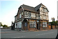
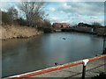
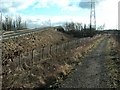

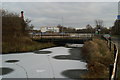


31 photos from this area
Area Information
Key information about the WA5 1EQ including its size, population, and administrative classification.
- Area Type
- Postcode
- Area Size
- 4714 m²
- Population
- 1374
- Population Density
- 3511 people/km²
House Prices in WA5 1EQ
29
Properties
£107,485
Average Sold Price
£27,500
Lowest Price
£190,000
Highest Price
Showing 29 properties
| Address | Type | Beds | Baths | Last Sale Price | Last Sale Date | |
|---|---|---|---|---|---|---|
| 1 Huntley Street, Great Sankey, Warrington, WA5 1EQ | Terraced | 3 | 2 | £190,000 | Dec 2025 | |
| 38 Huntley Street, Great Sankey, Warrington, WA5 1EQ | Terraced | 2 | 1 | £153,750 | Sep 2025 | |
| 46 Huntley Street, Great Sankey, Warrington, WA5 1EQ | Terraced | 2 | 1 | £160,000 | Aug 2025 | |
| 20 Huntley Street, Great Sankey, Warrington, WA5 1EQ | Terraced | 2 | 1 | £130,000 | Oct 2024 | |
| 42 Huntley Street, Great Sankey, Warrington, WA5 1EQ | Terraced | 2 | 1 | £130,000 | May 2022 | |
| 34 Huntley Street, Great Sankey, Warrington, WA5 1EQ | Terraced | 2 | 1 | £103,000 | Nov 2020 | |
| 8 Huntley Street, Great Sankey, Warrington, WA5 1EQ | house | - | - | £113,000 | Nov 2020 | |
| 11 Huntley Street, Great Sankey, Warrington, WA5 1EQ | Terraced | 3 | - | £130,000 | Jun 2020 | |
| 16 Huntley Street, Great Sankey, Warrington, WA5 1EQ | Terraced | 2 | 1 | £105,500 | Jan 2020 | |
| 36 Huntley Street, Great Sankey, Warrington, WA5 1EQ | Terraced | 2 | 1 | £104,000 | Dec 2019 |
Page 1 of 3
Energy Efficiency in WA5 1EQ
Amenities
Schools
| Rank | School | Type | Entry gender | Ages |
|---|
Explore more schools in this area
Go to Schools tabDemographics
Household Size
Two person
most common
Accommodation Type
Houses
most common
Tenure
84
majority
Ethnic Group
White
most common
Religion
N/A
most common
Household Composition
N/A
most common
Age
47
median
Adults (30-64 years)
most common
Household Deprivation
N/A
with no deprivation
NS-SEC
34
in Lower managerial occupations
Explore more demographic insights in this area
Go to Demographics tabPlanning
Planning Constraints
- Flood RiskPremium
- Ramsar Wetland SitesPremium
- Area of Outstanding Natural BeautyPremium
- Protected Nature ReservePremium
- Protected WoodlandPremium