Area Overview for WA2 0NQ
Photos of WA2 0NQ
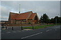
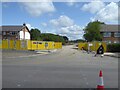
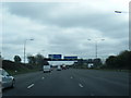
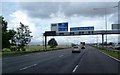


17 photos from this area
Area Information
Key information about the WA2 0NQ including its size, population, and administrative classification.
- Area Type
- Postcode
- Area Size
- 8786 m²
- Population
- 1484
- Population Density
- 6845 people/km²
House Prices in WA2 0NQ
36
Properties
£107,235
Average Sold Price
£21,580
Lowest Price
£163,000
Highest Price
Showing 36 properties
| Address | Type | Beds | Baths | Last Sale Price | Last Sale Date | |
|---|---|---|---|---|---|---|
| 77 Ullswater Avenue, Poplars And Hulme, Warrington, WA2 0NQ | house | - | - | £150,000 | Sep 2023 | |
| 34 Ullswater Avenue, Poplars And Hulme, Warrington, WA2 0NQ | Terraced | 2 | 1 | £163,000 | Jan 2023 | |
| 55 Ullswater Avenue, Poplars And Hulme, Warrington, WA2 0NQ | house | - | - | £142,000 | Mar 2022 | |
| 75 Ullswater Avenue, Poplars And Hulme, Warrington, WA2 0NQ | house | 2 | - | £115,000 | Jul 2020 | |
| 47 Ullswater Avenue, Poplars And Hulme, Warrington, WA2 0NQ | Terraced | 3 | - | £146,000 | Aug 2018 | |
| 61 Ullswater Avenue, Poplars And Hulme, Warrington, WA2 0NQ | Terraced | 3 | 1 | £90,000 | Nov 2017 | |
| 63 Ullswater Avenue, Poplars And Hulme, Warrington, WA2 0NQ | Terraced | 3 | 1 | £107,000 | Jul 2017 | |
| 40 Ullswater Avenue, Poplars And Hulme, Warrington, WA2 0NQ | Semi-detached | - | - | £115,000 | Feb 2007 | |
| 44 Ullswater Avenue, Poplars And Hulme, Warrington, WA2 0NQ | house | - | - | £95,000 | Jul 2004 | |
| 54 Ullswater Avenue, Poplars And Hulme, Warrington, WA2 0NQ | Terraced | - | - | £21,580 | Sep 2002 |
Page 1 of 4
Energy Efficiency in WA2 0NQ
Amenities
Schools
| Rank | School | Type | Entry gender | Ages |
|---|
Explore more schools in this area
Go to Schools tabDemographics
Household Size
Family (3-5 people)
most common
Accommodation Type
Houses
most common
Tenure
45
majority
Ethnic Group
White
most common
Religion
N/A
most common
Household Composition
N/A
most common
Age
47
median
Adults (30-64 years)
most common
Household Deprivation
N/A
with no deprivation
NS-SEC
19
in Lower managerial occupations
Explore more demographic insights in this area
Go to Demographics tabPlanning
Planning Constraints
- Flood RiskPremium
- Ramsar Wetland SitesPremium
- Area of Outstanding Natural BeautyPremium
- Protected Nature ReservePremium
- Protected WoodlandPremium