Area Overview for WA11 8BA
Photos of WA11 8BA
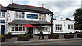

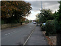
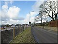
25 photos from this area
Area Information
Key information about the WA11 8BA including its size, population, and administrative classification.
- Area Type
- Postcode
- Area Size
- 2.3 hectares
- Population
- 1182
- Population Density
- 1626 people/km²
House Prices in WA11 8BA
49
Properties
£153,393
Average Sold Price
£47,750
Lowest Price
£280,000
Highest Price
Showing 49 properties
| Address | Type | Beds | Baths | Last Sale Price | Last Sale Date | |
|---|---|---|---|---|---|---|
| 51 Rookery Drive, Rainford, St Helens, WA11 8BA | Semi-detached | 2 | 1 | £235,000 | Jul 2023 | |
| 50 Rookery Drive, Rainford, St Helens, WA11 8BA | Semi-detached | 3 | 1 | £280,000 | Feb 2022 | |
| 65 Rookery Drive, Rainford, St Helens, WA11 8BA | Bungalow | - | - | £225,000 | Oct 2021 | |
| 40 Rookery Drive, Rainford, St Helens, WA11 8BA | Semi-detached | 3 | 2 | £215,000 | Nov 2020 | |
| 55 Rookery Drive, Rainford, St Helens, WA11 8BA | Bungalow | - | - | £145,000 | Nov 2019 | |
| 57 Rookery Drive, Rainford, St Helens, WA11 8BA | Bungalow | 2 | - | £149,950 | Feb 2019 | |
| 36 Rookery Drive, Rainford, St Helens, WA11 8BA | house | - | - | £205,000 | Jan 2019 | |
| 77 Rookery Drive, Rainford, St Helens, WA11 8BA | Semi-detached | 2 | 1 | £157,500 | Nov 2018 | |
| 44 Rookery Drive, Rainford, St Helens, WA11 8BA | house | - | - | £164,000 | Aug 2017 | |
| 71 Rookery Drive, Rainford, St Helens, WA11 8BA | Bungalow | 2 | - | £165,000 | Jan 2017 |
Page 1 of 5
Energy Efficiency in WA11 8BA
Amenities
Schools
| Rank | School | Type | Entry gender | Ages |
|---|
Explore more schools in this area
Go to Schools tabDemographics
Household Size
Two person
most common
Accommodation Type
Houses
most common
Tenure
93
majority
Ethnic Group
White
most common
Religion
N/A
most common
Household Composition
N/A
most common
Age
47
median
Adults (30-64 years)
most common
Household Deprivation
N/A
with no deprivation
NS-SEC
47
in Lower managerial occupations
Explore more demographic insights in this area
Go to Demographics tabPlanning
Planning Constraints
- Flood RiskPremium
- Ramsar Wetland SitesPremium
- Area of Outstanding Natural BeautyPremium
- Protected Nature ReservePremium
- Protected WoodlandPremium