Area Overview for WA10 3RS
Photos of WA10 3RS


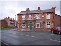
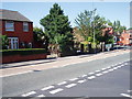
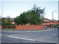
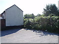
26 photos from this area
Area Information
Key information about the WA10 3RS including its size, population, and administrative classification.
- Area Type
- Postcode
- Area Size
- 8417 m²
- Population
- 1641
- Population Density
- 6706 people/km²
House Prices in WA10 3RS
18
Properties
£97,955
Average Sold Price
£27,000
Lowest Price
£197,500
Highest Price
Showing 18 properties
| Address | Type | Beds | Baths | Last Sale Price | Last Sale Date | |
|---|---|---|---|---|---|---|
| 47 Broadway, Thatto Heath, St Helens, WA10 3RS | Semi-detached | 3 | 1 | £175,000 | Jun 2022 | |
| 65 Broadway, Thatto Heath, St Helens, WA10 3RS | Semi-detached | 3 | 2 | £197,500 | Mar 2022 | |
| 49 Broadway, Thatto Heath, St Helens, WA10 3RS | house | - | - | £87,000 | Jul 2021 | |
| 45 Broadway, Thatto Heath, St Helens, WA10 3RS | Semi-detached | 3 | 1 | £138,000 | Jul 2019 | |
| 43 Broadway, Thatto Heath, St Helens, WA10 3RS | Semi-detached | 3 | - | £110,000 | Dec 2017 | |
| 57 Broadway, Thatto Heath, St Helens, WA10 3RS | house | - | - | £105,000 | Dec 2016 | |
| 51 Broadway, Thatto Heath, St Helens, WA10 3RS | Semi-detached | 3 | 2 | £80,000 | Apr 2005 | |
| 59 Broadway, Thatto Heath, St Helens, WA10 3RS | Terraced | - | - | £46,000 | Jan 2005 | |
| 41 Broadway, Thatto Heath, St Helens, WA10 3RS | house | - | - | £48,000 | Aug 2002 | |
| 63 Broadway, Thatto Heath, St Helens, WA10 3RS | Semi-detached | - | - | £27,000 | Oct 2001 |
Page 1 of 2
Energy Efficiency in WA10 3RS
Amenities
Schools
| Rank | School | Type | Entry gender | Ages |
|---|
Explore more schools in this area
Go to Schools tabDemographics
Household Size
Family (3-5 people)
most common
Accommodation Type
Houses
most common
Tenure
66
majority
Ethnic Group
White
most common
Religion
N/A
most common
Household Composition
N/A
most common
Age
47
median
Adults (30-64 years)
most common
Household Deprivation
N/A
with no deprivation
NS-SEC
26
in Lower managerial occupations
Explore more demographic insights in this area
Go to Demographics tabPlanning
Planning Constraints
- Flood RiskPremium
- Ramsar Wetland SitesPremium
- Area of Outstanding Natural BeautyPremium
- Protected Nature ReservePremium
- Protected WoodlandPremium