Area Overview for WA10 3RR
Photos of WA10 3RR


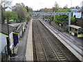


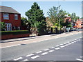
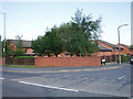
26 photos from this area
Area Information
Key information about the WA10 3RR including its size, population, and administrative classification.
- Area Type
- Postcode
- Area Size
- 8990 m²
- Population
- 1641
- Population Density
- 6706 people/km²
House Prices in WA10 3RR
31
Properties
£88,106
Average Sold Price
£43,000
Lowest Price
£122,500
Highest Price
Showing 31 properties
| Address | Type | Beds | Baths | Last Sale Price | Last Sale Date | |
|---|---|---|---|---|---|---|
| 42 Springfield Road, Thatto Heath, St Helens, WA10 3RR | Semi-detached | 4 | 1 | £122,000 | Jul 2024 | |
| 40 Springfield Road, Thatto Heath, St Helens, WA10 3RR | house | - | - | £91,000 | Nov 2020 | |
| 121 Springfield Road, Thatto Heath, St Helens, WA10 3RR | Semi-detached | 3 | 1 | £95,000 | Jul 2020 | |
| 56 Springfield Road, Thatto Heath, St Helens, WA10 3RR | Semi-detached | 3 | 1 | £108,000 | Sep 2018 | |
| 101 Springfield Road, Thatto Heath, St Helens, WA10 3RR | Semi-detached | 3 | 1 | £87,500 | May 2018 | |
| 60 Springfield Road, Thatto Heath, St Helens, WA10 3RR | house | - | - | £122,500 | Aug 2016 | |
| 113 Springfield Road, Thatto Heath, St Helens, WA10 3RR | Semi-detached | - | - | £76,950 | Feb 2004 | |
| 103 Springfield Road, Thatto Heath, St Helens, WA10 3RR | Semi-detached | - | - | £47,000 | Nov 2002 | |
| 50 Springfield Road, Thatto Heath, St Helens, WA10 3RR | house | - | - | £43,000 | Nov 1996 | |
| 52 Springfield Road, Thatto Heath, St Helens, WA10 3RR | Semi-detached | 3 | 1 | - | - |
Page 1 of 4
Energy Efficiency in WA10 3RR
Amenities
Schools
| Rank | School | Type | Entry gender | Ages |
|---|
Explore more schools in this area
Go to Schools tabDemographics
Household Size
Family (3-5 people)
most common
Accommodation Type
Houses
most common
Tenure
66
majority
Ethnic Group
White
most common
Religion
N/A
most common
Household Composition
N/A
most common
Age
47
median
Adults (30-64 years)
most common
Household Deprivation
N/A
with no deprivation
NS-SEC
26
in Lower managerial occupations
Explore more demographic insights in this area
Go to Demographics tabPlanning
Planning Constraints
- Flood RiskPremium
- Ramsar Wetland SitesPremium
- Area of Outstanding Natural BeautyPremium
- Protected Nature ReservePremium
- Protected WoodlandPremium