Area Overview for SK8 7QE
Photos of SK8 7QE

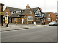
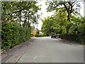
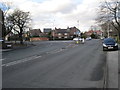
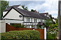
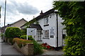
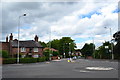
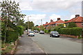
18 photos from this area
Area Information
Key information about the SK8 7QE including its size, population, and administrative classification.
- Area Type
- Postcode
- Area Size
- 9888 m²
- Population
- 1269
- Population Density
- 4527 people/km²
House Prices in SK8 7QE
31
Properties
£237,037
Average Sold Price
£74,000
Lowest Price
£450,000
Highest Price
Showing 31 properties
| Address | Type | Beds | Baths | Last Sale Price | Last Sale Date | |
|---|---|---|---|---|---|---|
| 4 Waverley Drive, Cheadle Hulme, Cheadle, SK8 7QE | house | - | - | £327,000 | Oct 2023 | |
| 34 Waverley Drive, Cheadle Hulme, Cheadle, SK8 7QE | house | - | - | £450,000 | Nov 2022 | |
| 7 Waverley Drive, Cheadle Hulme, Cheadle, SK8 7QE | Semi-detached | 5 | - | £358,000 | Jun 2021 | |
| 28 Waverley Drive, Cheadle Hulme, Cheadle, SK8 7QE | house | - | - | £285,000 | Jun 2021 | |
| 42 Waverley Drive, Cheadle Hulme, Cheadle, SK8 7QE | house | - | - | £314,500 | Mar 2021 | |
| 48 Waverley Drive, Cheadle Hulme, Cheadle, SK8 7QE | house | - | - | £290,000 | Dec 2018 | |
| 9 Waverley Drive, Cheadle Hulme, Cheadle, SK8 7QE | house | - | - | £283,000 | Aug 2018 | |
| 46 Waverley Drive, Cheadle Hulme, Cheadle, SK8 7QE | house | - | - | £290,000 | Aug 2017 | |
| 14 Waverley Drive, Cheadle Hulme, Cheadle, SK8 7QE | Semi-detached | 3 | 1 | £258,000 | Feb 2016 | |
| 3 Waverley Drive, Cheadle Hulme, Cheadle, SK8 7QE | Semi-detached | 3 | 1 | £240,000 | Jul 2015 |
Page 1 of 4
Energy Efficiency in SK8 7QE
Amenities
Schools
| Rank | School | Type | Entry gender | Ages |
|---|
Explore more schools in this area
Go to Schools tabDemographics
Household Size
Family (3-5 people)
most common
Accommodation Type
Houses
most common
Tenure
92
majority
Ethnic Group
White
most common
Religion
N/A
most common
Household Composition
N/A
most common
Age
47
median
Adults (30-64 years)
most common
Household Deprivation
N/A
with no deprivation
NS-SEC
51
in Lower managerial occupations
Explore more demographic insights in this area
Go to Demographics tabPlanning
Planning Constraints
- Flood RiskPremium
- Ramsar Wetland SitesPremium
- Area of Outstanding Natural BeautyPremium
- Protected Nature ReservePremium
- Protected WoodlandPremium