Area Overview for SK8 7QD
Photos of SK8 7QD
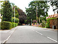
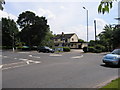
13 photos from this area
Area Information
Key information about the SK8 7QD including its size, population, and administrative classification.
- Area Type
- Postcode
- Area Size
- 5571 m²
- Population
- 1269
- Population Density
- 4527 people/km²
House Prices in SK8 7QD
10
Properties
£307,989
Average Sold Price
£79,950
Lowest Price
£600,000
Highest Price
Showing 10 properties
| Address | Type | Beds | Baths | Last Sale Price | Last Sale Date | |
|---|---|---|---|---|---|---|
| 44 Yew Tree Park Road, Cheadle Hulme, Cheadle, SK8 7QD | Semi-detached | 3 | 1 | £385,000 | Sep 2022 | |
| 25 Yew Tree Park Road, Cheadle Hulme, Cheadle, SK8 7QD | Detached | 4 | 2 | £482,000 | Dec 2020 | |
| 38 Yew Tree Park Road, Cheadle Hulme, Cheadle, SK8 7QD | Detached | 5 | 2 | £600,000 | Aug 2020 | |
| 32 Yew Tree Park Road, Cheadle Hulme, Cheadle, SK8 7QD | house | - | - | £278,000 | Nov 2018 | |
| 42 Yew Tree Park Road, Cheadle Hulme, Cheadle, SK8 7QD | Semi-detached | - | - | £290,000 | Feb 2017 | |
| 30 Yew Tree Park Road, Cheadle Hulme, Cheadle, SK8 7QD | house | - | - | £180,000 | Oct 2013 | |
| 40 Yew Tree Park Road, Cheadle Hulme, Cheadle, SK8 7QD | Semi-detached | 3 | 1 | £197,000 | Jun 2009 | |
| 34 Yew Tree Park Road, Cheadle Hulme, Cheadle, SK8 7QD | Terraced | - | - | £279,950 | Nov 2006 | |
| 46 Yew Tree Park Road, Cheadle Hulme, Cheadle, SK8 7QD | Semi-detached | - | - | £79,950 | Dec 1997 | |
| 36 Yew Tree Park Road, Cheadle Hulme, Cheadle, SK8 7QD | Terraced | - | - | - | - |
Energy Efficiency in SK8 7QD
Amenities
Schools
| Rank | School | Type | Entry gender | Ages |
|---|
Explore more schools in this area
Go to Schools tabDemographics
Household Size
Family (3-5 people)
most common
Accommodation Type
Houses
most common
Tenure
92
majority
Ethnic Group
White
most common
Religion
N/A
most common
Household Composition
N/A
most common
Age
47
median
Adults (30-64 years)
most common
Household Deprivation
N/A
with no deprivation
NS-SEC
51
in Lower managerial occupations
Explore more demographic insights in this area
Go to Demographics tabPlanning
Planning Constraints
- Flood RiskPremium
- Ramsar Wetland SitesPremium
- Area of Outstanding Natural BeautyPremium
- Protected Nature ReservePremium
- Protected WoodlandPremium