Area Overview for SK8 4BY
Photos of SK8 4BY

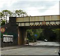
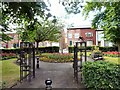
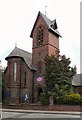
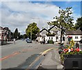
57 photos from this area
Area Information
Key information about the SK8 4BY including its size, population, and administrative classification.
- Area Type
- Postcode
- Area Size
- 2.8 hectares
- Population
- 2066
- Population Density
- 2457 people/km²
House Prices in SK8 4BY
39
Properties
£192,010
Average Sold Price
£38,000
Lowest Price
£430,000
Highest Price
Showing 39 properties
| Address | Type | Beds | Baths | Last Sale Price | Last Sale Date | |
|---|---|---|---|---|---|---|
| 7 Saville Road, Gatley, Cheadle, SK8 4BY | house | 3 | 1 | £340,000 | Sep 2025 | |
| 75 Saville Road, Gatley, Cheadle, SK8 4BY | Semi-detached | 2 | 1 | £250,000 | Aug 2024 | |
| 21 Saville Road, Gatley, Cheadle, SK8 4BY | house | - | - | £290,000 | Nov 2023 | |
| 17 Saville Road, Gatley, Cheadle, SK8 4BY | Semi-detached | 4 | 1 | £430,000 | Oct 2023 | |
| 41 Saville Road, Gatley, Cheadle, SK8 4BY | house | 3 | 1 | £336,000 | Feb 2022 | |
| 11 Saville Road, Gatley, Cheadle, SK8 4BY | house | - | - | £360,000 | Feb 2022 | |
| 77 Saville Road, Gatley, Cheadle, SK8 4BY | house | - | - | £314,000 | Jul 2021 | |
| 49 Saville Road, Gatley, Cheadle, SK8 4BY | house | 3 | 1 | £265,000 | May 2021 | |
| 37 Saville Road, Gatley, Cheadle, SK8 4BY | house | 3 | 1 | £150,000 | Sep 2020 | |
| 43 Saville Road, Gatley, Cheadle, SK8 4BY | house | - | - | £245,000 | Apr 2019 |
Page 1 of 4
Energy Efficiency in SK8 4BY
Amenities
Schools
| Rank | School | Type | Entry gender | Ages |
|---|
Explore more schools in this area
Go to Schools tabDemographics
Household Size
Family (3-5 people)
most common
Accommodation Type
Houses
most common
Tenure
91
majority
Ethnic Group
White
most common
Religion
N/A
most common
Household Composition
N/A
most common
Age
47
median
Adults (30-64 years)
most common
Household Deprivation
N/A
with no deprivation
NS-SEC
52
in Lower managerial occupations
Explore more demographic insights in this area
Go to Demographics tabPlanning
Planning Constraints
- Flood RiskPremium
- Ramsar Wetland SitesPremium
- Area of Outstanding Natural BeautyPremium
- Protected Nature ReservePremium
- Protected WoodlandPremium