Area Overview for SK8 4AF
Photos of SK8 4AF

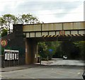
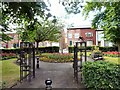
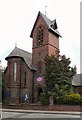
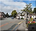
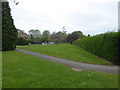
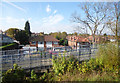
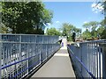
57 photos from this area
Area Information
Key information about the SK8 4AF including its size, population, and administrative classification.
- Area Type
- Postcode
- Area Size
- 1.7 hectares
- Population
- 1439
- Population Density
- 3628 people/km²
House Prices in SK8 4AF
48
Properties
£217,173
Average Sold Price
£58,300
Lowest Price
£442,500
Highest Price
Showing 48 properties
| Address | Type | Beds | Baths | Last Sale Price | Last Sale Date | |
|---|---|---|---|---|---|---|
| 34 Leyland Avenue, Gatley, Cheadle, SK8 4AF | house | - | - | £330,000 | Feb 2025 | |
| 3 Leyland Avenue, Gatley, Cheadle, SK8 4AF | Semi-detached | 3 | 2 | £442,500 | May 2024 | |
| 22 Leyland Avenue, Gatley, Cheadle, SK8 4AF | Terraced | - | - | £200,000 | May 2023 | |
| 29 Leyland Avenue, Gatley, Cheadle, SK8 4AF | Semi-detached | 3 | 1 | £375,000 | Mar 2023 | |
| 7 Leyland Avenue, Gatley, Cheadle, SK8 4AF | house | - | - | £333,000 | Sep 2022 | |
| 39 Leyland Avenue, Gatley, Cheadle, SK8 4AF | house | - | - | £365,000 | Jun 2021 | |
| 14 Leyland Avenue, Gatley, Cheadle, SK8 4AF | house | - | - | £376,000 | Apr 2019 | |
| 10 Leyland Avenue, Gatley, Cheadle, SK8 4AF | house | 3 | 1 | £300,000 | Jul 2018 | |
| 6 Leyland Avenue, Gatley, Cheadle, SK8 4AF | Semi-detached | 3 | 1 | £284,000 | Feb 2017 | |
| 21 Leyland Avenue, Gatley, Cheadle, SK8 4AF | Semi-detached | 3 | - | £287,000 | Aug 2016 |
Page 1 of 5
Energy Efficiency in SK8 4AF
Amenities
Schools
| Rank | School | Type | Entry gender | Ages |
|---|
Explore more schools in this area
Go to Schools tabDemographics
Household Size
Family (3-5 people)
most common
Accommodation Type
Houses
most common
Tenure
78
majority
Ethnic Group
White
most common
Religion
N/A
most common
Household Composition
N/A
most common
Age
47
median
Adults (30-64 years)
most common
Household Deprivation
N/A
with no deprivation
NS-SEC
47
in Lower managerial occupations
Explore more demographic insights in this area
Go to Demographics tabPlanning
Planning Constraints
- Flood RiskPremium
- Ramsar Wetland SitesPremium
- Area of Outstanding Natural BeautyPremium
- Protected Nature ReservePremium
- Protected WoodlandPremium