Area Overview for SK8 3TG
Photos of SK8 3TG
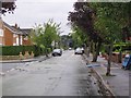
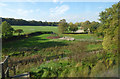

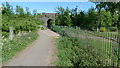
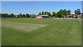
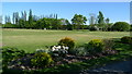
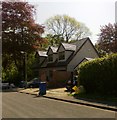
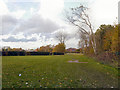
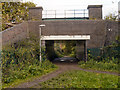
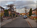
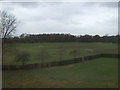
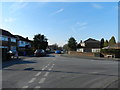
21 photos from this area
Area Information
Key information about the SK8 3TG including its size, population, and administrative classification.
- Area Type
- Postcode
- Area Size
- 15.0 hectares
- Population
- 1633
- Population Density
- 2268 people/km²
House Prices in SK8 3TG
29
Properties
£336,311
Average Sold Price
£65,000
Lowest Price
£625,000
Highest Price
Showing 29 properties
| Address | Type | Beds | Baths | Last Sale Price | Last Sale Date | |
|---|---|---|---|---|---|---|
| 119 Styal Road, Gatley, Cheadle, SK8 3TG | Bungalow | - | - | £435,000 | Feb 2023 | |
| 126 Styal Road, Gatley, Cheadle, SK8 3TG | Bungalow | - | - | £625,000 | Sep 2022 | |
| 120 Styal Road, Gatley, Cheadle, SK8 3TG | Semi-detached | 2 | - | £430,000 | Mar 2021 | |
| 139 Styal Road, Gatley, Cheadle, SK8 3TG | Bungalow | 3 | 2 | £552,860 | Jan 2020 | |
| 120A Styal Road, Gatley, Cheadle, SK8 3TG | house | - | - | £275,000 | Jun 2019 | |
| 121 Styal Road, Gatley, Cheadle, SK8 3TG | Bungalow | 3 | 2 | £485,000 | Feb 2019 | |
| 117 Styal Road, Gatley, Cheadle, SK8 3TG | Bungalow | - | - | £540,000 | Jan 2018 | |
| 113 Styal Road, Gatley, Cheadle, SK8 3TG | Bungalow | 4 | 3 | £325,000 | Oct 2014 | |
| 125 Styal Road, Gatley, Cheadle, SK8 3TG | Bungalow | 3 | 2 | £285,000 | Dec 2013 | |
| 115 Styal Road, Gatley, Cheadle, SK8 3TG | Detached | - | - | £355,000 | Apr 2009 |
Page 1 of 3
Energy Efficiency in SK8 3TG
Amenities
Schools
| Rank | School | Type | Entry gender | Ages |
|---|
Explore more schools in this area
Go to Schools tabDemographics
Household Size
Two person
most common
Accommodation Type
Houses
most common
Tenure
91
majority
Ethnic Group
White
most common
Religion
N/A
most common
Household Composition
N/A
most common
Age
47
median
Adults (30-64 years)
most common
Household Deprivation
N/A
with no deprivation
NS-SEC
45
in Lower managerial occupations
Explore more demographic insights in this area
Go to Demographics tabPlanning
Planning Constraints
- Flood RiskPremium
- Ramsar Wetland SitesPremium
- Area of Outstanding Natural BeautyPremium
- Protected Nature ReservePremium
- Protected WoodlandPremium