Area Overview for M22 5AT
Photos of M22 5AT


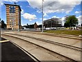

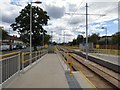
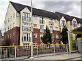
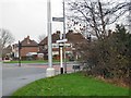

28 photos from this area
Area Information
Key information about the M22 5AT including its size, population, and administrative classification.
- Area Type
- Postcode
- Area Size
- 3.1 hectares
- Population
- 1523
- Population Density
- 4955 people/km²
House Prices in M22 5AT
38
Properties
£111,333
Average Sold Price
£26,500
Lowest Price
£232,000
Highest Price
Showing 38 properties
| Address | Type | Beds | Baths | Last Sale Price | Last Sale Date | |
|---|---|---|---|---|---|---|
| 19 Cadnam Drive, Manchester, M22 5AT | Retail | 3 | 2 | £150,000 | Nov 2022 | |
| 1 Cadnam Drive, Manchester, M22 5AT | Terraced | 2 | 1 | £232,000 | Nov 2022 | |
| 15 Cadnam Drive, Manchester, M22 5AT | house | - | - | £160,000 | Mar 2021 | |
| 21 Cadnam Drive, Manchester, M22 5AT | house | - | - | £135,000 | May 2018 | |
| 13 Cadnam Drive, Manchester, M22 5AT | Terraced | 3 | 1 | £75,000 | Feb 2014 | |
| 39 Cadnam Drive, Manchester, M22 5AT | Terraced | - | - | £85,000 | Jul 2013 | |
| 10 Cadnam Drive, Manchester, M22 5AT | Terraced | - | - | £100,000 | Aug 2005 | |
| 12 Cadnam Drive, Manchester, M22 5AT | Terraced | - | - | £26,500 | Oct 1999 | |
| 27 Cadnam Drive, Manchester, M22 5AT | Terraced | - | - | £38,500 | May 1995 | |
| 31 Cadnam Drive, Manchester, M22 5AT | house | - | - | - | - |
Page 1 of 4
Energy Efficiency in M22 5AT
Amenities
Schools
| Rank | School | Type | Entry gender | Ages |
|---|
Explore more schools in this area
Go to Schools tabDemographics
Household Size
One person
most common
Accommodation Type
Houses
most common
Tenure
30
majority
Ethnic Group
White
most common
Religion
N/A
most common
Household Composition
N/A
most common
Age
47
median
Adults (30-64 years)
most common
Household Deprivation
N/A
with no deprivation
NS-SEC
17
in Lower managerial occupations
Explore more demographic insights in this area
Go to Demographics tabPlanning
Planning Constraints
- Flood RiskPremium
- Ramsar Wetland SitesPremium
- Area of Outstanding Natural BeautyPremium
- Protected Nature ReservePremium
- Protected WoodlandPremium