Area Overview for SK6 8EG
Photos of SK6 8EG
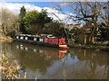
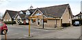
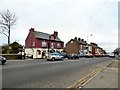
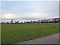
62 photos from this area
Area Information
Key information about the SK6 8EG including its size, population, and administrative classification.
- Area Type
- Postcode
- Area Size
- 3.0 hectares
- Population
- 1348
- Population Density
- 1531 people/km²
House Prices in SK6 8EG
28
Properties
£260,499
Average Sold Price
£78,950
Lowest Price
£493,000
Highest Price
Showing 28 properties
| Address | Type | Beds | Baths | Last Sale Price | Last Sale Date | |
|---|---|---|---|---|---|---|
| 24 Meadway, High Lane, Stockport, SK6 8EG | Bungalow | 3 | 1 | £493,000 | Jan 2025 | |
| 12 Meadway, High Lane, Stockport, SK6 8EG | Bungalow | - | - | £391,000 | Feb 2024 | |
| 10 Meadway, High Lane, Stockport, SK6 8EG | Bungalow | - | - | £370,000 | Feb 2024 | |
| 18 Meadway, High Lane, Stockport, SK6 8EG | Bungalow | - | - | £425,000 | Nov 2021 | |
| 1 Meadway, High Lane, Stockport, SK6 8EG | Bungalow | 2 | 1 | £283,500 | Dec 2020 | |
| 26 Meadway, High Lane, Stockport, SK6 8EG | Bungalow | - | - | £307,500 | Nov 2020 | |
| 3 Meadway, High Lane, Stockport, SK6 8EG | Bungalow | 3 | 1 | £280,000 | Jul 2018 | |
| 30 Meadway, High Lane, Stockport, SK6 8EG | Bungalow | 3 | 1 | £292,500 | May 2017 | |
| 15 Meadway, High Lane, Stockport, SK6 8EG | Bungalow | 3 | 1 | £270,000 | Dec 2016 | |
| 17 Meadway, High Lane, Stockport, SK6 8EG | Bungalow | - | - | £340,000 | Dec 2013 |
Page 1 of 3
Energy Efficiency in SK6 8EG
Amenities
Schools
| Rank | School | Type | Entry gender | Ages |
|---|
Explore more schools in this area
Go to Schools tabDemographics
Household Size
Two person
most common
Accommodation Type
Houses
most common
Tenure
90
majority
Ethnic Group
White
most common
Religion
N/A
most common
Household Composition
N/A
most common
Age
47
median
Adults (30-64 years)
most common
Household Deprivation
N/A
with no deprivation
NS-SEC
42
in Lower managerial occupations
Explore more demographic insights in this area
Go to Demographics tabPlanning
Planning Constraints
- Flood RiskPremium
- Ramsar Wetland SitesPremium
- Area of Outstanding Natural BeautyPremium
- Protected Nature ReservePremium
- Protected WoodlandPremium