Area Overview for SK6 5PP
Photos of SK6 5PP

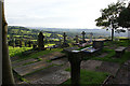
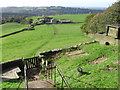
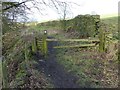
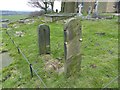
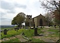

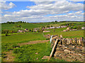
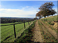
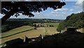

49 photos from this area
Area Information
Key information about the SK6 5PP including its size, population, and administrative classification.
- Area Type
- Postcode
- Area Size
- 4.7 hectares
- Population
- 1644
- Population Density
- 165 people/km²
House Prices in SK6 5PP
17
Properties
£336,688
Average Sold Price
£150,000
Lowest Price
£475,000
Highest Price
Showing 17 properties
| Address | Type | Beds | Baths | Last Sale Price | Last Sale Date | |
|---|---|---|---|---|---|---|
| 298 Longhurst Lane, Mellor, Stockport, SK6 5PP | house | - | - | £452,500 | Sep 2017 | |
| 284 Longhurst Lane, Mellor, Stockport, SK6 5PP | Bungalow | - | - | £442,000 | Mar 2016 | |
| 300 Longhurst Lane, Mellor, Stockport, SK6 5PP | Detached | 4 | 2 | £460,000 | Mar 2010 | |
| 301 Longhurst Lane, Mellor, Stockport, SK6 5PP | house | - | - | £475,000 | Oct 2008 | |
| 280 Longhurst Lane, Mellor, Stockport, SK6 5PP | Detached | - | - | £312,000 | Sep 2004 | |
| 302 Longhurst Lane, Mellor, Stockport, SK6 5PP | Semi-detached | 4 | 2 | £225,000 | May 2002 | |
| 292 Longhurst Lane, Mellor, Stockport, SK6 5PP | Semi-detached | - | - | £177,000 | Sep 1999 | |
| 290 Longhurst Lane, Mellor, Stockport, SK6 5PP | Semi-detached | 3 | - | £150,000 | May 1996 | |
| 288 Longhurst Lane, Mellor, Stockport, SK6 5PP | Semi-detached | 5 | 2 | - | - | |
| Public Convenience, Church Road, Mellor, Stockport, SK6 5PP | commercial | - | - | - | - |
Page 1 of 2
Energy Efficiency in SK6 5PP
Amenities
Schools
| Rank | School | Type | Entry gender | Ages |
|---|
Explore more schools in this area
Go to Schools tabDemographics
Household Size
Two person
most common
Accommodation Type
Houses
most common
Tenure
94
majority
Ethnic Group
White
most common
Religion
N/A
most common
Household Composition
N/A
most common
Age
47
median
Adults (30-64 years)
most common
Household Deprivation
N/A
with no deprivation
NS-SEC
58
in Lower managerial occupations
Explore more demographic insights in this area
Go to Demographics tabPlanning
Planning Constraints
- Flood RiskPremium
- Ramsar Wetland SitesPremium
- Area of Outstanding Natural BeautyPremium
- Protected Nature ReservePremium
- Protected WoodlandPremium