Area Overview for SK6 5LZ
Photos of SK6 5LZ


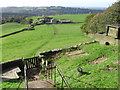
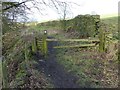

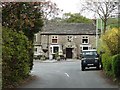
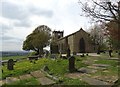

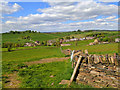
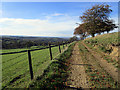
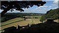

49 photos from this area
Area Information
Key information about the SK6 5LZ including its size, population, and administrative classification.
- Area Type
- Postcode
- Area Size
- 18.2 hectares
- Population
- 1644
- Population Density
- 165 people/km²
House Prices in SK6 5LZ
22
Properties
£469,250
Average Sold Price
£185,000
Lowest Price
£780,000
Highest Price
Showing 22 properties
| Address | Type | Beds | Baths | Last Sale Price | Last Sale Date | |
|---|---|---|---|---|---|---|
| 2 Gibb Lane, Mellor, Stockport, SK6 5LZ | house | - | - | £780,000 | Sep 2022 | |
| 11 Gibb Lane, Mellor, Stockport, SK6 5LZ | house | - | - | £750,000 | May 2022 | |
| Kenmair, 23 Gibb Lane, Mellor, Stockport, SK6 5LZ | Semi-detached | 3 | 2 | £667,500 | Apr 2022 | |
| 1 Gibb Lane, Mellor, Stockport, SK6 5LZ | Terraced | 3 | 1 | £400,000 | Feb 2015 | |
| 33A Gibb Lane, Mellor, Stockport, SK6 5LZ | Flat | - | - | £585,000 | Oct 2009 | |
| 15 Gibb Lane, Mellor, Stockport, SK6 5LZ | house | - | - | £525,000 | Nov 2007 | |
| Tarden Cottage, 84 Gibb Lane, Mellor, Stockport, SK6 5LZ | Terraced | - | - | £185,000 | Jun 2004 | |
| Primrose Cottage, 80 Gibb Lane, Mellor, Stockport, SK6 5LZ | Detached | - | - | £280,000 | Jun 2001 | |
| Gorse Hill, 39 Gibb Lane, Mellor, Stockport, SK6 5LZ | Detached | - | - | £250,000 | Jun 2001 | |
| Tarden, 96 Gibb Lane, Mellor, Stockport, SK6 5LZ | Semi-detached | 6 | 2 | £270,000 | Mar 2000 |
Page 1 of 3
Energy Efficiency in SK6 5LZ
Amenities
Schools
| Rank | School | Type | Entry gender | Ages |
|---|
Explore more schools in this area
Go to Schools tabDemographics
Household Size
Two person
most common
Accommodation Type
Houses
most common
Tenure
94
majority
Ethnic Group
White
most common
Religion
N/A
most common
Household Composition
N/A
most common
Age
47
median
Adults (30-64 years)
most common
Household Deprivation
N/A
with no deprivation
NS-SEC
58
in Lower managerial occupations
Explore more demographic insights in this area
Go to Demographics tabPlanning
Planning Constraints
- Flood RiskPremium
- Ramsar Wetland SitesPremium
- Area of Outstanding Natural BeautyPremium
- Protected Nature ReservePremium