Area Overview for SK4 5BE
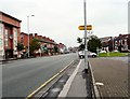
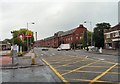
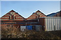
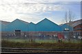
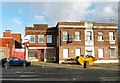
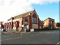
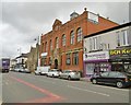
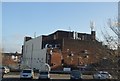
Photos of SK4 5BE


Area Information
SK4 5BE is a compact residential cluster covering 1.6 hectares in Greater Manchester. This small neighbourhood supports a population of 1,593 residents. The area sits within the SK4 postcode sector, known for its dense yet established housing. Living in SK4 5BE means residing in a tightly knit environment where every street is within walking distance of your neighbours. The high population density reflects a finely tuned urban layout designed for maximum convenience. You occupy a space that is small in footprint but rich in local character. This postcode represents a specific slice of the Salford City Council area, offering a quiet retreat from the busiest city centre routes. Despite its size, the location provides direct access to wider transport networks and local retail hubs. Residents here experience a community defined by proximity rather than sprawl. The area maintains its identity as a functional residential zone rather than a mixed-use development. Daily life revolves around getting from home to work, school, or the shops with minimal travel time. The compact nature of the neighbourhood creates a self-contained living experience where local amenities are immediately at hand.
- Area Type
- Postcode
- Area Size
- 1.6 hectares
- Population
- 1593
- Population Density
- 3188 people/km²
Homes in SK4 5BE reflect a market heavily weighted towards owner-occupation. With 84% of the population owning their property, you will rarely encounter a rental scheme in this specific cluster. The accommodation type consists almost exclusively of houses, ranging from semi-detached bungalows to larger detached properties. There are no blocks of flats within this postcode boundary. This housing stock appeals to buyers seeking permanence and who wish to customise their living spaces. The property market here is driven by families looking to upgrade or consolidate their assets rather than young investors flipping properties. If you are considering purchasing, competition will likely come from other owner-occupiers looking to downsize or expand. The absence of social housing or private lettings suggests a high barrier to entry for first-time buyers without existing savings. Local surveyors will note that the age of the housing stock matches the demographic profile of older, established owners. Maintenance responsibilities fall entirely on the resident, as there is no council or landlord management. This area is well suited to those with a mortgage who prefer a private garden and full control over their home. The small footprint of 1.6 hectares limits the variety of housing styles you will find compared to larger wards.
House Prices in SK4 5BE
Showing 28 properties
| Address | Type | Beds | Baths | Last Sale Price | Last Sale Date | |
|---|---|---|---|---|---|---|
| 2 Westholm Avenue, Heaton Chapel, Stockport, SK4 5BE | house | 3 | - | £250,000 | Feb 2024 | |
| 21 Westholm Avenue, Heaton Chapel, Stockport, SK4 5BE | Semi-detached | 4 | 1 | £316,500 | Nov 2023 | |
| 1 Westholm Avenue, Heaton Chapel, Stockport, SK4 5BE | house | - | - | £258,000 | Oct 2021 | |
| 14 Westholm Avenue, Heaton Chapel, Stockport, SK4 5BE | Semi-detached | 3 | 1 | £266,000 | Aug 2021 | |
| 8 Westholm Avenue, Heaton Chapel, Stockport, SK4 5BE | Semi-detached | 3 | 1 | £182,500 | Oct 2018 | |
| 22 Westholm Avenue, Heaton Chapel, Stockport, SK4 5BE | Semi-detached | 3 | 1 | £176,500 | Sep 2018 | |
| 28 Westholm Avenue, Heaton Chapel, Stockport, SK4 5BE | house | - | - | £125,000 | May 2018 | |
| 23 Westholm Avenue, Heaton Chapel, Stockport, SK4 5BE | Semi-detached | - | - | £158,000 | Feb 2008 | |
| 26 Westholm Avenue, Heaton Chapel, Stockport, SK4 5BE | Semi-detached | - | - | £158,000 | Dec 2007 | |
| 4 Westholm Avenue, Heaton Chapel, Stockport, SK4 5BE | Semi-detached | - | - | £129,950 | Jun 2007 |
Energy Efficiency in SK4 5BE
Living in SK4 5BE offers direct access to essential retail and leisure facilities. Within a short distance, you can shop at Aldi Heaton, Tesco Levenshulme, and Morrisons Daily. These supermarkets provide everything from fresh produce to household essentials without the need for a long journey. Local transport links are robust, with five stations accessible by rail including Levenshulme Railway Station, Heaton Chapel Railway Station, and Mauldeth Road Railway Station. The Metrolink system connects you to East Didsbury, Didsbury Village, and West Didsbury minutes away. You can walk to these stations or take a bus to Chorlton Street Coach Station for wider regional travel. The airport is also close, with Terminals One, Two, and Three within easy reach of the area. This network of amenities supports a lifestyle where local needs are met immediately while global travel remains convenient. Restaurants and restaurants in Salford City Centre, Heaton Moor, and Canalside are nearby attractions. The area balances the convenience of city living with the quiet of a residential estate. You will find all daily necessities without leaving the postcode or driving more than a few miles.
Amenities
Schools
Families living in SK4 5BE have immediate access to quality education nearby. North Heaton Primary School serves the local children. This primary institution is just a short journey from the homes on Blackstock Road. The school holds a rating from Ofsted, ensuring it meets national educational standards. While there are no secondary schools listed within the immediate data for this specific postcode, the primary option provides a solid foundation for local education. This single-school presence indicates a neighbourhood primarily populated by families with younger children. Parents in the area will need to arrange transport for older students or commute to secondary institutions outside the immediate ward. The proximity of North Heaton Primary School is a key selling point for new arrivals. It reduces drop-off times and integrates children into the local community quickly. You can expect to see the school gates from your driveway during drop-off and pick-up times. The concentration of primary education suggests that school holidays and community events in the early years will dominate local activity. This educational provision supports the demographic profile of a mature family neighbourhood.
| Rank | School | Type | Entry gender | Ages |
|---|
Explore more schools in this area
Go to Schools tabDemographics
The community in SK4 5BE is mature and stable, with a median age of 47 years. Most residents fall into the adult age range of 30 to 64 years. This profile suggests an area favoured by established families and professionals seeking stability. Home ownership stands at a significant 84% average, indicating a territory dominated by owners rather than tenants. This high rate of ownership often correlates with longer-term residency and community investment. Houses form the primary accommodation type for this postcode. The thoroughfare is Blackstock Road, and the properties are generally detached, semi-detached, or terraced family homes owned by their occupants. White residents form the predominant ethnic group in this section of Manchester. The demographic makeup reflects a traditional suburban pattern common in the Heaton and Didsbury corridors. You are likely to meet neighbours who have lived in their homes for decades. The lack of recent student inflows or young professional enclaves creates a consistent local flavour. This stability is evident in the age distribution and the strong preference for buying over renting. Families here value a familiar environment where local schools and habits remain constant over time.
Household Size
Accommodation Type
Tenure
Ethnic Group
Religion
Household Composition
Age
Household Deprivation
NS-SEC
Explore more demographic insights in this area
Go to Demographics tabPlanning
Planning Constraints
- Flood RiskPremium
- Ramsar Wetland SitesPremium
- Area of Outstanding Natural BeautyPremium
- Protected Nature ReservePremium
- Protected WoodlandPremium