Area Overview for SK2 7NR
Photos of SK2 7NR
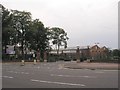
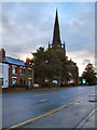
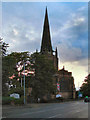


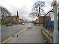
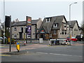
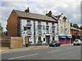
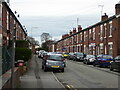
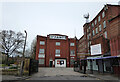
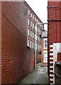

54 photos from this area
Area Information
Key information about the SK2 7NR including its size, population, and administrative classification.
- Area Type
- Postcode
- Area Size
- 5316 m²
- Population
- 1539
- Population Density
- 5096 people/km²
House Prices in SK2 7NR
11
Properties
£101,400
Average Sold Price
£60,000
Lowest Price
£145,000
Highest Price
Showing 11 properties
| Address | Type | Beds | Baths | Last Sale Price | Last Sale Date | |
|---|---|---|---|---|---|---|
| Flat, 281 Buxton Road, Great Moor, Stockport, SK2 7NR | Flat | - | - | £145,000 | Mar 2022 | |
| 269 Buxton Road, Great Moor, Stockport, SK2 7NR | Flat | - | - | £90,000 | Oct 2019 | |
| 273 Buxton Road, Great Moor, Stockport, SK2 7NR | Terraced | 2 | 1 | £90,000 | Nov 2015 | |
| 271 Buxton Road, Great Moor, Stockport, SK2 7NR | Terraced | - | - | £122,000 | Mar 2007 | |
| 279A Buxton Road, Great Moor, Stockport, SK2 7NR | Flat | - | - | £60,000 | Feb 2003 | |
| 285 Buxton Road, Great Moor, Stockport, SK2 7NR | Retail | - | - | - | - | |
| 269A Buxton Road, Great Moor, Stockport, SK2 7NR | Flat | 2 | 1 | - | - | |
| 285A Buxton Road, Great Moor, Stockport, SK2 7NR | Flat | 2 | 1 | - | - | |
| 277A Buxton Road, Great Moor, Stockport, SK2 7NR | Flat | - | - | - | - | |
| 265A Buxton Road, Great Moor, Stockport, SK2 7NR | Flat | - | - | - | - |
Page 1 of 2
Energy Efficiency in SK2 7NR
Amenities
Schools
| Rank | School | Type | Entry gender | Ages |
|---|
Explore more schools in this area
Go to Schools tabDemographics
Household Size
Two person
most common
Accommodation Type
Houses
most common
Tenure
74
majority
Ethnic Group
White
most common
Religion
N/A
most common
Household Composition
N/A
most common
Age
47
median
Adults (30-64 years)
most common
Household Deprivation
N/A
with no deprivation
NS-SEC
36
in Lower managerial occupations
Explore more demographic insights in this area
Go to Demographics tabPlanning
Planning Constraints
- Flood RiskPremium
- Ramsar Wetland SitesPremium
- Area of Outstanding Natural BeautyPremium
- Protected Nature ReservePremium
- Protected WoodlandPremium