Area Overview for SK2 7AN
Photos of SK2 7AN


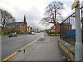
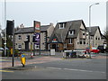
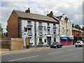
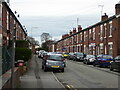

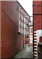

54 photos from this area
Area Information
Key information about the SK2 7AN including its size, population, and administrative classification.
- Area Type
- Postcode
- Area Size
- 8976 m²
- Population
- 2219
- Population Density
- 2838 people/km²
House Prices in SK2 7AN
31
Properties
£165,788
Average Sold Price
£40,500
Lowest Price
£495,000
Highest Price
Showing 31 properties
| Address | Type | Beds | Baths | Last Sale Price | Last Sale Date | |
|---|---|---|---|---|---|---|
| 310 Buxton Road, Great Moor, Stockport, SK2 7AN | Terraced | 3 | 1 | £178,000 | Oct 2022 | |
| 302 Buxton Road, Great Moor, Stockport, SK2 7AN | Terraced | 2 | 2 | £148,000 | May 2019 | |
| 300 Buxton Road, Great Moor, Stockport, SK2 7AN | Terraced | 2 | - | £148,950 | Jan 2018 | |
| 246 Buxton Road, Great Moor, Stockport, SK2 7AN | Semi-detached | 1 | 2 | £138,000 | Oct 2017 | |
| 306 Buxton Road, Great Moor, Stockport, SK2 7AN | Terraced | 3 | 1 | £118,000 | Sep 2017 | |
| 244 Buxton Road, Great Moor, Stockport, SK2 7AN | house | 3 | - | £230,000 | Jan 2015 | |
| 294A Buxton Road, Great Moor, Stockport, SK2 7AN | Flat | - | - | £108,000 | Feb 2010 | |
| 248 Buxton Road, Great Moor, Stockport, SK2 7AN | house | 3 | - | £125,000 | Mar 2008 | |
| Lynmere Nursing Home, 278 Buxton Road, Great Moor, Stockport, SK2 7AN | Retirement | - | - | £495,000 | Oct 2005 | |
| 242 Buxton Road, Great Moor, Stockport, SK2 7AN | Semi-detached | 3 | 2 | £215,000 | Oct 2005 |
Page 1 of 4
Energy Efficiency in SK2 7AN
Amenities
Schools
| Rank | School | Type | Entry gender | Ages |
|---|
Explore more schools in this area
Go to Schools tabDemographics
Household Size
Family (3-5 people)
most common
Accommodation Type
Houses
most common
Tenure
76
majority
Ethnic Group
White
most common
Religion
N/A
most common
Household Composition
N/A
most common
Age
47
median
Adults (30-64 years)
most common
Household Deprivation
N/A
with no deprivation
NS-SEC
42
in Lower managerial occupations
Explore more demographic insights in this area
Go to Demographics tabPlanning
Planning Constraints
- Flood RiskPremium
- Ramsar Wetland SitesPremium
- Area of Outstanding Natural BeautyPremium
- Protected Nature ReservePremium
- Protected WoodlandPremium