Area Overview for SK15 2TL
Photos of SK15 2TL
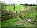
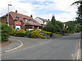
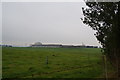
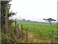
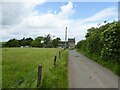
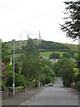
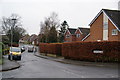
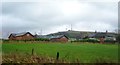
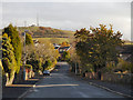
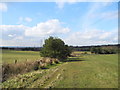
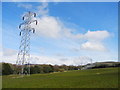
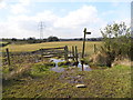
23 photos from this area
Area Information
Key information about the SK15 2TL including its size, population, and administrative classification.
- Area Type
- Postcode
- Area Size
- 9110 m²
- Population
- 1615
- Population Density
- 1486 people/km²
House Prices in SK15 2TL
16
Properties
£234,400
Average Sold Price
£95,000
Lowest Price
£625,000
Highest Price
Showing 16 properties
| Address | Type | Beds | Baths | Last Sale Price | Last Sale Date | |
|---|---|---|---|---|---|---|
| 9 Matley Park Lane, Stalybridge, SK15 2TL | Bungalow | - | - | £310,000 | Dec 2025 | |
| 22 Matley Park Lane, Stalybridge, SK15 2TL | house | - | - | £625,000 | Mar 2021 | |
| 2 Matley Park Lane, Stalybridge, SK15 2TL | Bungalow | 2 | 1 | £220,000 | Aug 2018 | |
| 20 Matley Park Lane, Stalybridge, SK15 2TL | Bungalow | 4 | 2 | £243,000 | Jul 2013 | |
| 6 Matley Park Lane, Stalybridge, SK15 2TL | Bungalow | - | - | £165,000 | Jan 2013 | |
| 5 Matley Park Lane, Stalybridge, SK15 2TL | Semi-detached | 2 | - | £155,000 | Dec 2012 | |
| 16 Matley Park Lane, Stalybridge, SK15 2TL | Bungalow | 3 | - | £177,000 | Nov 2011 | |
| 4 Matley Park Lane, Stalybridge, SK15 2TL | Detached | - | - | £248,000 | Jul 2007 | |
| 1 Matley Park Lane, Stalybridge, SK15 2TL | house | - | - | £106,000 | May 2001 | |
| 8 Matley Park Lane, Stalybridge, SK15 2TL | Detached | - | - | £95,000 | May 1999 |
Page 1 of 2
Energy Efficiency in SK15 2TL
Amenities
Schools
| Rank | School | Type | Entry gender | Ages |
|---|
Explore more schools in this area
Go to Schools tabDemographics
Household Size
Two person
most common
Accommodation Type
Houses
most common
Tenure
93
majority
Ethnic Group
White
most common
Religion
N/A
most common
Household Composition
N/A
most common
Age
47
median
Adults (30-64 years)
most common
Household Deprivation
N/A
with no deprivation
NS-SEC
48
in Lower managerial occupations
Explore more demographic insights in this area
Go to Demographics tabPlanning
Planning Constraints
- Flood RiskPremium
- Ramsar Wetland SitesPremium
- Area of Outstanding Natural BeautyPremium
- Protected Nature ReservePremium
- Protected WoodlandPremium