Area Overview for SK15 2TB
Photos of SK15 2TB
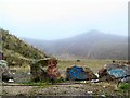
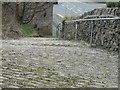
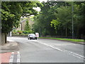
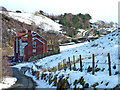
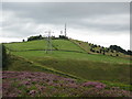
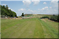
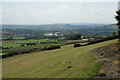
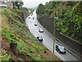
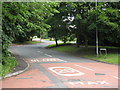

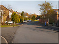
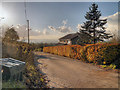
49 photos from this area
Area Information
Key information about the SK15 2TB including its size, population, and administrative classification.
- Area Type
- Postcode
- Area Size
- 1.4 hectares
- Population
- 1615
- Population Density
- 1486 people/km²
House Prices in SK15 2TB
25
Properties
£254,881
Average Sold Price
£59,950
Lowest Price
£430,000
Highest Price
Showing 25 properties
| Address | Type | Beds | Baths | Last Sale Price | Last Sale Date | |
|---|---|---|---|---|---|---|
| 38 Bardsley Gate Avenue, Stalybridge, SK15 2TB | Detached | 3 | 2 | £365,500 | Mar 2025 | |
| 12 Bardsley Gate Avenue, Stalybridge, SK15 2TB | Detached | 3 | 2 | £430,000 | Jan 2025 | |
| 44 Bardsley Gate Avenue, Stalybridge, SK15 2TB | house | - | - | £325,000 | Feb 2022 | |
| 40 Bardsley Gate Avenue, Stalybridge, SK15 2TB | Bungalow | - | - | £280,000 | Jun 2021 | |
| 28 Bardsley Gate Avenue, Stalybridge, SK15 2TB | Semi-detached | 2 | 1 | £260,000 | Aug 2020 | |
| 2 Bardsley Gate Avenue, Stalybridge, SK15 2TB | Detached | 3 | - | £255,000 | Apr 2018 | |
| 24 Bardsley Gate Avenue, Stalybridge, SK15 2TB | Bungalow | - | - | £250,000 | Feb 2018 | |
| 14 Bardsley Gate Avenue, Stalybridge, SK15 2TB | Bungalow | 3 | 1 | £222,000 | Apr 2017 | |
| 10 Bardsley Gate Avenue, Stalybridge, SK15 2TB | Bungalow | - | - | £230,000 | Aug 2016 | |
| 30 Bardsley Gate Avenue, Stalybridge, SK15 2TB | Bungalow | 2 | 1 | £218,000 | Aug 2015 |
Page 1 of 3
Energy Efficiency in SK15 2TB
Amenities
Schools
| Rank | School | Type | Entry gender | Ages |
|---|
Explore more schools in this area
Go to Schools tabDemographics
Household Size
Two person
most common
Accommodation Type
Houses
most common
Tenure
93
majority
Ethnic Group
White
most common
Religion
N/A
most common
Household Composition
N/A
most common
Age
47
median
Adults (30-64 years)
most common
Household Deprivation
N/A
with no deprivation
NS-SEC
48
in Lower managerial occupations
Explore more demographic insights in this area
Go to Demographics tabPlanning
Planning Constraints
- Flood RiskPremium
- Ramsar Wetland SitesPremium
- Area of Outstanding Natural BeautyPremium
- Protected Nature ReservePremium
- Protected WoodlandPremium