Area Overview for SK15 1LH
Photos of SK15 1LH
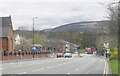
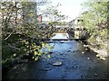
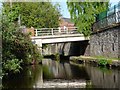
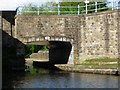
100 photos from this area
Area Information
Key information about the SK15 1LH including its size, population, and administrative classification.
- Area Type
- Postcode
- Area Size
- 6709 m²
- Population
- 1415
- Population Density
- 4263 people/km²
House Prices in SK15 1LH
37
Properties
£64,359
Average Sold Price
£25,395
Lowest Price
£96,500
Highest Price
Showing 37 properties
| Address | Type | Beds | Baths | Last Sale Price | Last Sale Date | |
|---|---|---|---|---|---|---|
| 127 Stamford Street, Stalybridge, SK15 1LH | Terraced | 4 | 2 | £96,500 | May 2021 | |
| 125 Stamford Street, Stalybridge, SK15 1LH | Terraced | 2 | 1 | £85,000 | Aug 2019 | |
| 115 Stamford Street, Stalybridge, SK15 1LH | Terraced | 2 | 1 | £63,761 | Sep 2015 | |
| 123 Stamford Street, Stalybridge, SK15 1LH | Terraced | 2 | 1 | £48,000 | May 2011 | |
| 119 Stamford Street, Stalybridge, SK15 1LH | Terraced | - | - | £67,500 | Jul 2004 | |
| 117 Stamford Street, Stalybridge, SK15 1LH | Terraced | - | - | £25,395 | Aug 1996 | |
| 1, Woodvale Park, 111 Stamford Street, Stalybridge, SK15 1LH | Flat | - | - | - | - | |
| 5, Woodvale Park, 111 Stamford Street, Stalybridge, SK15 1LH | Flat | - | - | - | - | |
| 24, Woodvale Park, 111 Stamford Street, Stalybridge, SK15 1LH | Flat | - | - | - | - | |
| 22, Woodvale Park, 111 Stamford Street, Stalybridge, SK15 1LH | Flat | - | - | - | - |
Page 1 of 4
Energy Efficiency in SK15 1LH
Amenities
Schools
| Rank | School | Type | Entry gender | Ages |
|---|
Explore more schools in this area
Go to Schools tabDemographics
Household Size
Two person
most common
Accommodation Type
Houses
most common
Tenure
58
majority
Ethnic Group
White
most common
Religion
N/A
most common
Household Composition
N/A
most common
Age
47
median
Adults (30-64 years)
most common
Household Deprivation
N/A
with no deprivation
NS-SEC
24
in Lower managerial occupations
Explore more demographic insights in this area
Go to Demographics tabPlanning
Planning Constraints
- Flood RiskPremium
- Ramsar Wetland SitesPremium
- Area of Outstanding Natural BeautyPremium
- Protected Nature ReservePremium
- Protected WoodlandPremium