Area Overview for SK14 2DB
Photos of SK14 2DB
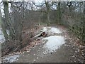
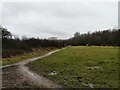
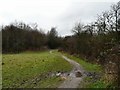
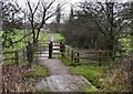
100 photos from this area
Area Information
Key information about the SK14 2DB including its size, population, and administrative classification.
- Area Type
- Postcode
- Area Size
- 3.9 hectares
- Population
- 1891
- Population Density
- 2866 people/km²
House Prices in SK14 2DB
32
Properties
£164,331
Average Sold Price
£40,000
Lowest Price
£285,000
Highest Price
Showing 32 properties
| Address | Type | Beds | Baths | Last Sale Price | Last Sale Date | |
|---|---|---|---|---|---|---|
| 24 Kingston Gardens, Hyde, SK14 2DB | Semi-detached | 3 | 1 | £285,000 | Sep 2024 | |
| 15 Kingston Gardens, Hyde, SK14 2DB | Semi-detached | 2 | 1 | £240,000 | Sep 2022 | |
| 11 Kingston Gardens, Hyde, SK14 2DB | house | 2 | 1 | £207,000 | Jul 2022 | |
| 17 Kingston Gardens, Hyde, SK14 2DB | Semi-detached | 2 | 1 | £217,500 | Apr 2021 | |
| 20 Kingston Gardens, Hyde, SK14 2DB | house | - | - | £162,000 | Nov 2020 | |
| 5 Kingston Gardens, Hyde, SK14 2DB | Bungalow | 4 | 2 | £282,500 | Jun 2020 | |
| 25 Kingston Gardens, Hyde, SK14 2DB | Semi-detached | 3 | 1 | £195,000 | Jun 2020 | |
| 26 Kingston Gardens, Hyde, SK14 2DB | Bungalow | 3 | 1 | £210,000 | Jul 2019 | |
| 1 Kingston Gardens, Hyde, SK14 2DB | Terraced | 5 | 2 | £260,000 | Sep 2018 | |
| 12 Kingston Gardens, Hyde, SK14 2DB | Semi-detached | 3 | 1 | £195,000 | Aug 2018 |
Page 1 of 4
Energy Efficiency in SK14 2DB
Amenities
Schools
| Rank | School | Type | Entry gender | Ages |
|---|
Explore more schools in this area
Go to Schools tabDemographics
Household Size
Family (3-5 people)
most common
Accommodation Type
Houses
most common
Tenure
48
majority
Ethnic Group
asian_total
most common
Religion
N/A
most common
Household Composition
N/A
most common
Age
47
median
Adults (30-64 years)
most common
Household Deprivation
N/A
with no deprivation
NS-SEC
18
in Lower managerial occupations
Explore more demographic insights in this area
Go to Demographics tabPlanning
Planning Constraints
- Flood RiskPremium
- Ramsar Wetland SitesPremium
- Area of Outstanding Natural BeautyPremium
- Protected Nature ReservePremium
- Protected WoodlandPremium