Area Overview for SK12 1EQ
Photos of SK12 1EQ
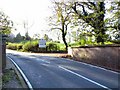
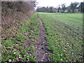

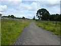
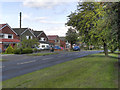
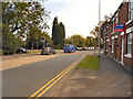
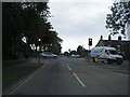
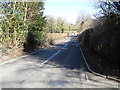
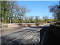
22 photos from this area
Area Information
Key information about the SK12 1EQ including its size, population, and administrative classification.
- Area Type
- Postcode
- Area Size
- 3.9 hectares
- Population
- 1376
- Population Density
- 742 people/km²
House Prices in SK12 1EQ
12
Properties
£348,595
Average Sold Price
£150,000
Lowest Price
£540,000
Highest Price
Showing 12 properties
| Address | Type | Beds | Baths | Last Sale Price | Last Sale Date | |
|---|---|---|---|---|---|---|
| 7 Mill Hill Avenue, Poynton, SK12 1EQ | Bungalow | - | - | £380,000 | Oct 2021 | |
| 19 Mill Hill Avenue, Poynton, SK12 1EQ | house | - | - | £482,000 | Nov 2020 | |
| 15 Mill Hill Avenue, Poynton, SK12 1EQ | house | - | - | £479,000 | Nov 2019 | |
| 5 Mill Hill Avenue, Poynton, SK12 1EQ | Bungalow | 2 | - | £290,000 | Feb 2018 | |
| 21 Mill Hill Avenue, Poynton, SK12 1EQ | house | - | - | £265,000 | Aug 2017 | |
| 11 Mill Hill Avenue, Poynton, SK12 1EQ | Bungalow | 3 | - | £540,000 | Sep 2016 | |
| 17 Mill Hill Avenue, Poynton, SK12 1EQ | house | 4 | - | £340,000 | Jul 2011 | |
| 3 Mill Hill Avenue, Poynton, SK12 1EQ | Semi-detached | - | - | £310,000 | Jun 2008 | |
| 1 Mill Hill Avenue, Poynton, SK12 1EQ | Semi-detached | 2 | - | £249,950 | Oct 2007 | |
| 9 Mill Hill Avenue, Poynton, SK12 1EQ | Detached | 3 | - | £150,000 | Jun 2002 |
Page 1 of 2
Energy Efficiency in SK12 1EQ
Amenities
Schools
| Rank | School | Type | Entry gender | Ages |
|---|
Explore more schools in this area
Go to Schools tabDemographics
Household Size
Two person
most common
Accommodation Type
Houses
most common
Tenure
93
majority
Ethnic Group
White
most common
Religion
N/A
most common
Household Composition
N/A
most common
Age
47
median
Adults (30-64 years)
most common
Household Deprivation
N/A
with no deprivation
NS-SEC
52
in Lower managerial occupations
Explore more demographic insights in this area
Go to Demographics tabPlanning
Planning Constraints
- Flood RiskPremium
- Ramsar Wetland SitesPremium
- Area of Outstanding Natural BeautyPremium
- Protected Nature ReservePremium
- Protected WoodlandPremium