Area Overview for SK7 5JS
Photos of SK7 5JS

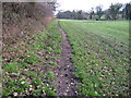

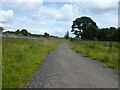
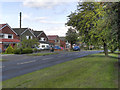
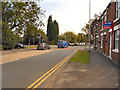
22 photos from this area
Area Information
Key information about the SK7 5JS including its size, population, and administrative classification.
- Area Type
- Postcode
- Area Size
- 21.9 hectares
- Population
- 1187
- Population Density
- 1607 people/km²
House Prices in SK7 5JS
16
Properties
£401,106
Average Sold Price
£197,000
Lowest Price
£643,000
Highest Price
Showing 16 properties
| Address | Type | Beds | Baths | Last Sale Price | Last Sale Date | |
|---|---|---|---|---|---|---|
| Chestnut Rise, Jacksons Lane, Hazel Grove, Stockport, SK7 5JS | Bungalow | 4 | 2 | £550,000 | May 2025 | |
| The Pines, Jacksons Lane, Hazel Grove, Stockport, SK7 5JS | Detached | 5 | 3 | £315,000 | Aug 2024 | |
| Oakfield, Jacksons Lane, Hazel Grove, Stockport, SK7 5JS | Detached | 6 | 3 | £643,000 | Aug 2020 | |
| White Cottage, Jacksons Lane, Hazel Grove, Stockport, SK7 5JS | house | - | - | £550,000 | Apr 2018 | |
| Alva, Jacksons Lane, Hazel Grove, Stockport, SK7 5JS | Bungalow | - | - | £385,000 | May 2016 | |
| Querida, Jacksons Lane, Hazel Grove, Stockport, SK7 5JS | Detached | 4 | - | £290,000 | Sep 2012 | |
| Button Oak, Jacksons Lane, Hazel Grove, Stockport, SK7 5JS | Detached | - | - | £430,000 | May 2010 | |
| Highfield House, Jacksons Lane, Hazel Grove, Stockport, SK7 5JS | Detached | 4 | 2 | £249,950 | Jun 2002 | |
| Moordale, Jacksons Lane, Hazel Grove, Stockport, SK7 5JS | house | - | - | £197,000 | Nov 2001 | |
| Norbury House, Jacksons Lane, Hazel Grove, Stockport, SK7 5JS | Detached | 5 | 5 | - | - |
Page 1 of 2
Energy Efficiency in SK7 5JS
Amenities
Schools
| Rank | School | Type | Entry gender | Ages |
|---|
Explore more schools in this area
Go to Schools tabDemographics
Household Size
Two person
most common
Accommodation Type
Houses
most common
Tenure
91
majority
Ethnic Group
White
most common
Religion
N/A
most common
Household Composition
N/A
most common
Age
47
median
Adults (30-64 years)
most common
Household Deprivation
N/A
with no deprivation
NS-SEC
39
in Lower managerial occupations
Explore more demographic insights in this area
Go to Demographics tabPlanning
Planning Constraints
- Flood RiskPremium
- Ramsar Wetland SitesPremium
- Area of Outstanding Natural BeautyPremium
- Protected Nature ReservePremium
- Protected WoodlandPremium