Area Overview for SK11 8NT
Photos of SK11 8NT


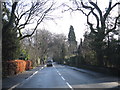
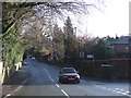
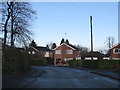
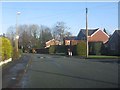
13 photos from this area
Area Information
Key information about the SK11 8NT including its size, population, and administrative classification.
- Area Type
- Postcode
- Area Size
- 3.7 hectares
- Population
- 1493
- Population Density
- 3689 people/km²
House Prices in SK11 8NT
43
Properties
£293,449
Average Sold Price
£82,000
Lowest Price
£1,053,565
Highest Price
Showing 43 properties
| Address | Type | Beds | Baths | Last Sale Price | Last Sale Date | |
|---|---|---|---|---|---|---|
| 63 Park Mount Drive, Macclesfield, SK11 8NT | Bungalow | 2 | 1 | £575,000 | Aug 2025 | |
| 75 Park Mount Drive, Macclesfield, SK11 8NT | Bungalow | 2 | 1 | £385,000 | Jun 2025 | |
| 71 Park Mount Drive, Macclesfield, SK11 8NT | Bungalow | 3 | 2 | £378,000 | May 2022 | |
| 46 Park Mount Drive, Macclesfield, SK11 8NT | Bungalow | 4 | 4 | £1,053,565 | Jun 2021 | |
| 6 Park Mount Drive, Macclesfield, SK11 8NT | Bungalow | - | - | £260,000 | Jul 2020 | |
| 40 Park Mount Drive, Macclesfield, SK11 8NT | Detached | 4 | 2 | £340,000 | Oct 2019 | |
| 38 Park Mount Drive, Macclesfield, SK11 8NT | Detached | 4 | 1 | £350,000 | Jul 2019 | |
| 4 Park Mount Drive, Macclesfield, SK11 8NT | Bungalow | - | - | £339,000 | Jan 2017 | |
| 18 Park Mount Drive, Macclesfield, SK11 8NT | Bungalow | 2 | - | £300,000 | Dec 2016 | |
| 26 Park Mount Drive, Macclesfield, SK11 8NT | house | - | - | £382,500 | May 2015 |
Page 1 of 5
Energy Efficiency in SK11 8NT
Amenities
Schools
| Rank | School | Type | Entry gender | Ages |
|---|
Explore more schools in this area
Go to Schools tabDemographics
Household Size
Two person
most common
Accommodation Type
Houses
most common
Tenure
94
majority
Ethnic Group
White
most common
Religion
N/A
most common
Household Composition
N/A
most common
Age
47
median
Adults (30-64 years)
most common
Household Deprivation
N/A
with no deprivation
NS-SEC
48
in Lower managerial occupations
Explore more demographic insights in this area
Go to Demographics tabPlanning
Planning Constraints
- Flood RiskPremium
- Ramsar Wetland SitesPremium
- Area of Outstanding Natural BeautyPremium
- Protected Nature ReservePremium
- Protected WoodlandPremium