Area Overview for SK11 7UD
Photos of SK11 7UD


Area Information
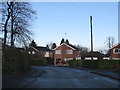
Living in SK11 7UD means inhabiting a very small, dense cluster of residences in Cheshire. This specific postcode covers just 4,135 square metres, yet it accommodates a resident population of 1,837 people. The result is an exceptionally high population density of 444,287 people per square kilometre, indicating a tightly packed residential environment where neighbours are likely just metres away. You are stepping into a specific residential enclave rather than a sprawling neighbourhood, where the living experience is defined by immediate proximity to other homes. This area sits within the broader SK post town, offering a compact footprint for those who prefer a contained living space. The sheer concentration of people in such a limited footprint suggests a community where public spaces are shared and local interaction faces the daily reality of a high-density microsite. For a prospective buyer, you must understand that this code identifies a specific slice of the Thornton or Ivymeade landscape, distinct from neighbouring villages. The area lacks the expansive green buffers common in wider Cheshire suburbs, creating a microcosm of urban-style density within a suburban setting. Daily life here involves navigating a space where you may never walk far to reach another property, yet you remain part of a larger town infrastructure.
- Area Type
- Postcode
- Area Size
- 4135 m²
- Population
- 1837
- Population Density
- 5292 people/km²
The housing market in SK11 7UD is defined almost exclusively by private homeownership, with a staggering 89% ownership rate in this specific postcode. You are looking at a market where speculative investment buy-to-let properties are virtually non-existent, replaced instead by families and long-term residents. The accommodation type is restricted to houses, which eliminates the competition between flats and houses that characterises larger towns like Macclesfield or Manchester. This singular focus on houses means property prices here reflect the full cost of independent dwelling maintenance, such as gardens and driveways, rather than shared building costs. When you consider homes in SK11 7UD, you are dealing with a micro-market where supply is extremely limited due to the small physical area of only 4,135 square metres. This constraint means any home for sale will attract immediate attention from the 1,837 local population. The high ownership percentage suggests that mortgage lenders view this as a low-risk area due to established equity bases. However, the sheer density of 444,287 people per square kilometre indicates that land scarcity drives value. You are entering a buying arena where competition for specific addresses is fierce because there are few escape routes for residents looking to move within this tight cluster. This is not a buyer's market for bargain hunters, but a premium market for those seeking a specific house within a compact, exclusive-enforced postcode.
House Prices in SK11 7UD
Showing 16 properties
| Address | Type | Beds | Baths | Last Sale Price | Last Sale Date | |
|---|---|---|---|---|---|---|
| 15 Rudyard Close, Macclesfield, SK11 7UD | house | - | - | £175,000 | Oct 2020 | |
| 3 Rudyard Close, Macclesfield, SK11 7UD | Terraced | 2 | 1 | £166,500 | Sep 2017 | |
| 17 Rudyard Close, Macclesfield, SK11 7UD | Terraced | 2 | 1 | £160,000 | Jul 2016 | |
| 2 Rudyard Close, Macclesfield, SK11 7UD | Flat | - | - | £128,000 | Jul 2016 | |
| 7 Rudyard Close, Macclesfield, SK11 7UD | Semi-detached | - | - | £175,000 | Oct 2015 | |
| 12 Rudyard Close, Macclesfield, SK11 7UD | Flat | 2 | 1 | £108,000 | Jun 2015 | |
| 4 Rudyard Close, Macclesfield, SK11 7UD | Maisonette | - | - | £99,950 | May 2014 | |
| 11 Rudyard Close, Macclesfield, SK11 7UD | house | 2 | - | £134,000 | Oct 2010 | |
| 6 Rudyard Close, Macclesfield, SK11 7UD | Flat | - | - | £130,000 | Feb 2010 | |
| 1 Rudyard Close, Macclesfield, SK11 7UD | Terraced | - | - | £124,000 | Nov 2006 |
Energy Efficiency in SK11 7UD
Daily life for residents of SK11 7UD revolves around practical amenities located just beyond the immediate postcode boundary. You have access to five retail outlets, including Co-op Thornton, Co-op Ivymeade, and Co-op London, ensuring everyday necessities like groceries are within a short drive. Transport links are equally accessible, with five rail stations available for your commute. Macclesfield Railway Station, Prestbury Railway Station, and Adlington Railway Station offer connections to Manchester and stockport. Manchester Woodford Airport is also a nearby facility, providing regional air travel options. While living in SK11 7UD means you are surrounded by houses, the convenience of these wider-town amenities makes the small 4,135 square metre cluster feel expansive in reach. You do not need to travel far to run errands, yet you have major transport hubs on your doorstep. The presence of multiple Co-op branches suggests a strong retail network catering to local shoppers. This combination of local shops and major railway interchanges provides a balanced lifestyle where you enjoy village convenience while maintaining city connectivity. The area serves as a conduit between the immediate residential cluster and the broader transport spine of Cheshire. Your daily routine can incorporate quick trips to Sears for groceries or train travel to the city centre without sacrificing the peacefulness of a house-based residential setting.
Amenities
Schools
Families considering SK11 7UD benefit from proximity to Ivy Bank Primary School, which holds an Ofsted rating of good. This is a state-funded primary institution serving the local cluster. Ivy Bank offers a dedicated educational environment for young children living in this dense residential zone. With no secondary schools listed within the immediate data for this specific postcode, the catchment area likely extends towards Thornton or Macclesfield for older children. The presence of a rated primary school ensures that early years education is accessible without crossing significant geographic barriers. However, the absence of secondary data in this shortlist means you must verify college and comprehensive school placements beyond this specific code. Ivy Bank Primary School stands as the sole confirmed educational facility directly associated with this postcode in the provided records. For parents moving to SK11 7UD, enrolling children here offers a stable start to their education within the community. The single presence of one primary school indicates that the local population of 1,837 children is managed by a single institution, suggesting class sizes may reflect this concentrated intake. You should investigate the 30-minute travel time to the nearest town hub for older education needs, as this specific data cluster only confirms the primary level provision.
| Rank | School | Type | Entry gender | Ages |
|---|
Explore more schools in this area
Go to Schools tabDemographics
The community of 1,837 people in SK11 7UD reflects a mature demographic profile with a median age of 47 years. Most residents fall into the adult bracket between 30 and 64 years old, suggesting a family-oriented neighbourhood with significant stability. Homeownership is the dominant tenure model, with 89% of properties owned outright or through a mortgage. This overwhelmingly high ownership rate contrasts sharply with the high rental markets found in many urban centres. The local housing stock is entirely composed of houses, meaning you will find detached, semi-detached, or terraced family properties rather than flats or converted apartments. This architectural preference aligns with the single-density accommodation type recorded for this cluster. The predominant ethnic group is White, mirroring the traditional demographic character of many established Cheshire villages. There are no data points suggesting a significant influx of younger professionals under 30, nor is there a younger tenant workforce driving the local economy. This stable population structure often correlates with quieter streets and established community ties, though you should remain aware that a median age of 47 implies a gradual transition of households as residents age. The lack of flats in this stock type means services tailored to single occupants or shared housing arrangements are less likely to be present within the immediate cluster itself.
Household Size
Accommodation Type
Tenure
Ethnic Group
Religion
Household Composition
Age
Household Deprivation
NS-SEC
Explore more demographic insights in this area
Go to Demographics tabPlanning
Planning Constraints
- Flood RiskPremium
- Ramsar Wetland SitesPremium
- Area of Outstanding Natural BeautyPremium
- Protected Nature ReservePremium
- Protected WoodlandPremium