Area Overview for SK10 5QQ
Photos of SK10 5QQ
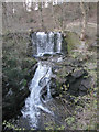
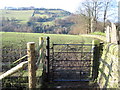
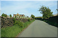
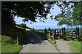
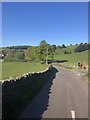
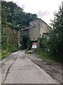
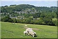
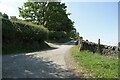
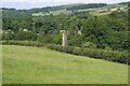
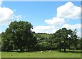
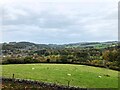
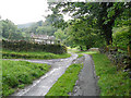
32 photos from this area
Area Information
Key information about the SK10 5QQ including its size, population, and administrative classification.
- Area Type
- Postcode
- Area Size
- 1.4 hectares
- Population
- 2358
- Population Density
- 1220 people/km²
House Prices in SK10 5QQ
27
Properties
£182,800
Average Sold Price
£8,400
Lowest Price
£275,000
Highest Price
Showing 27 properties
| Address | Type | Beds | Baths | Last Sale Price | Last Sale Date | |
|---|---|---|---|---|---|---|
| 26 Lowther Street, Bollington, SK10 5QQ | house | - | - | £275,000 | Aug 2025 | |
| 21 Lowther Street, Bollington, SK10 5QQ | Bungalow | 2 | 1 | £245,000 | May 2025 | |
| 28 Lowther Street, Bollington, SK10 5QQ | house | - | - | £224,000 | Jun 2024 | |
| 12 Lowther Street, Bollington, SK10 5QQ | Terraced | 3 | 1 | £215,000 | Dec 2023 | |
| 24 Lowther Street, Bollington, SK10 5QQ | house | - | - | £225,000 | Dec 2021 | |
| 6A Lowther Street, Bollington, SK10 5QQ | house | - | - | £274,950 | Sep 2021 | |
| 6B Lowther Street, Bollington, SK10 5QQ | Cottage | 2 | - | £265,000 | Dec 2020 | |
| 6 Lowther Street, Bollington, SK10 5QQ | Cottage | 2 | - | £232,000 | Jan 2019 | |
| The Old School House, 6D Lowther Street, Bollington, SK10 5QQ | Semi-detached | 3 | 1 | £8,400 | Feb 2018 | |
| 6C Lowther Street, Bollington, SK10 5QQ | house | - | - | £204,000 | May 2016 |
Page 1 of 3
Energy Efficiency in SK10 5QQ
Amenities
Schools
| Rank | School | Type | Entry gender | Ages |
|---|
Explore more schools in this area
Go to Schools tabDemographics
Household Size
Two person
most common
Accommodation Type
Houses
most common
Tenure
76
majority
Ethnic Group
White
most common
Religion
N/A
most common
Household Composition
N/A
most common
Age
47
median
Adults (30-64 years)
most common
Household Deprivation
N/A
with no deprivation
NS-SEC
44
in Lower managerial occupations
Explore more demographic insights in this area
Go to Demographics tabPlanning
Planning Constraints
- Flood RiskPremium
- Ramsar Wetland SitesPremium
- Area of Outstanding Natural BeautyPremium
- Protected Nature ReservePremium
- Protected WoodlandPremium