Area Overview for SK10 3LE
Photos of SK10 3LE

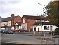

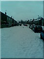
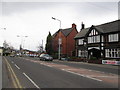
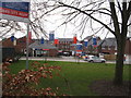


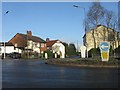
19 photos from this area
Area Information
Key information about the SK10 3LE including its size, population, and administrative classification.
- Area Type
- Postcode
- Area Size
- 1.8 hectares
- Population
- 1360
- Population Density
- 4620 people/km²
House Prices in SK10 3LE
50
Properties
£216,080
Average Sold Price
£59,900
Lowest Price
£348,000
Highest Price
Showing 50 properties
| Address | Type | Beds | Baths | Last Sale Price | Last Sale Date | |
|---|---|---|---|---|---|---|
| 63 Dalesford Crescent, Macclesfield, SK10 3LE | Semi-detached | 3 | 1 | £295,000 | Aug 2024 | |
| 79 Dalesford Crescent, Macclesfield, SK10 3LE | house | 3 | 1 | £317,500 | Feb 2023 | |
| 25 Dalesford Crescent, Macclesfield, SK10 3LE | house | - | - | £348,000 | Feb 2022 | |
| 69 Dalesford Crescent, Macclesfield, SK10 3LE | Semi-detached | 3 | 1 | £250,000 | Oct 2020 | |
| 15 Dalesford Crescent, Macclesfield, SK10 3LE | house | - | - | £225,000 | Aug 2020 | |
| 99 Dalesford Crescent, Macclesfield, SK10 3LE | Semi-detached | 4 | 2 | £303,000 | Oct 2019 | |
| 13 Dalesford Crescent, Macclesfield, SK10 3LE | house | 3 | 1 | £267,500 | Sep 2019 | |
| 49 Dalesford Crescent, Macclesfield, SK10 3LE | house | - | - | £230,000 | Sep 2019 | |
| 91 Dalesford Crescent, Macclesfield, SK10 3LE | Semi-detached | 4 | 2 | £289,000 | Feb 2019 | |
| 41 Dalesford Crescent, Macclesfield, SK10 3LE | house | 3 | 1 | £255,000 | Dec 2017 |
Page 1 of 5
Energy Efficiency in SK10 3LE
Amenities
Schools
| Rank | School | Type | Entry gender | Ages |
|---|
Explore more schools in this area
Go to Schools tabDemographics
Household Size
Two person
most common
Accommodation Type
Houses
most common
Tenure
87
majority
Ethnic Group
White
most common
Religion
N/A
most common
Household Composition
N/A
most common
Age
47
median
Adults (30-64 years)
most common
Household Deprivation
N/A
with no deprivation
NS-SEC
40
in Lower managerial occupations
Explore more demographic insights in this area
Go to Demographics tabPlanning
Planning Constraints
- Flood RiskPremium
- Ramsar Wetland SitesPremium
- Area of Outstanding Natural BeautyPremium
- Protected Nature ReservePremium
- Protected WoodlandPremium