Area Overview for SK10 3LD
Photos of SK10 3LD

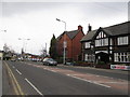
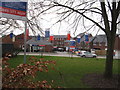
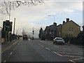


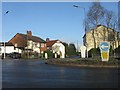
19 photos from this area
Area Information
Key information about the SK10 3LD including its size, population, and administrative classification.
- Area Type
- Postcode
- Area Size
- 2.5 hectares
- Population
- 1360
- Population Density
- 4620 people/km²
House Prices in SK10 3LD
49
Properties
£168,197
Average Sold Price
£37,000
Lowest Price
£350,000
Highest Price
Showing 49 properties
| Address | Type | Beds | Baths | Last Sale Price | Last Sale Date | |
|---|---|---|---|---|---|---|
| 6 Fallibroome Road, Macclesfield, SK10 3LD | Semi-detached | 3 | 1 | £290,000 | Dec 2024 | |
| 59 Fallibroome Road, Macclesfield, SK10 3LD | Detached | 4 | 1 | £350,000 | Mar 2023 | |
| 45 Fallibroome Road, Macclesfield, SK10 3LD | house | - | - | £290,000 | Oct 2022 | |
| 13 Fallibroome Road, Macclesfield, SK10 3LD | house | - | - | £145,000 | Mar 2022 | |
| 55 Fallibroome Road, Macclesfield, SK10 3LD | house | - | - | £236,000 | Apr 2021 | |
| 39 Fallibroome Road, Macclesfield, SK10 3LD | Detached | 3 | 1 | £245,000 | Feb 2021 | |
| 33 Fallibroome Road, Macclesfield, SK10 3LD | Semi-detached | 3 | 1 | £230,000 | Jan 2020 | |
| 27 Fallibroome Road, Macclesfield, SK10 3LD | Semi-detached | 3 | 1 | £225,000 | Jul 2019 | |
| 23 Fallibroome Road, Macclesfield, SK10 3LD | Terraced | 2 | 1 | £105,000 | Jul 2019 | |
| 11 Fallibroome Road, Macclesfield, SK10 3LD | Terraced | 2 | 1 | £130,000 | May 2019 |
Page 1 of 5
Energy Efficiency in SK10 3LD
Amenities
Schools
| Rank | School | Type | Entry gender | Ages |
|---|
Explore more schools in this area
Go to Schools tabDemographics
Household Size
Two person
most common
Accommodation Type
Houses
most common
Tenure
87
majority
Ethnic Group
White
most common
Religion
N/A
most common
Household Composition
N/A
most common
Age
47
median
Adults (30-64 years)
most common
Household Deprivation
N/A
with no deprivation
NS-SEC
40
in Lower managerial occupations
Explore more demographic insights in this area
Go to Demographics tabPlanning
Planning Constraints
- Flood RiskPremium
- Ramsar Wetland SitesPremium
- Area of Outstanding Natural BeautyPremium
- Protected Nature ReservePremium
- Protected WoodlandPremium